Massachusetts Archives
Town plans, 1830
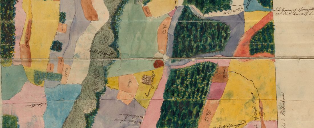
Detail from:
Plan of Wilbraham made by Aaron Bliss, dated 1830
For the compilation of a more accurate state map, each town in Massachusetts (and the city of Boston) was required by Resolves 1829, c 50 to make a town plan based on a survey no more than five years old, to be submitted to the state secretary's office. Plans, to be drawn on a scale of one hundred rods to the inch, were to include the following information: rivers, waterways, public and private roads, places of public worship, courthouses, other public buildings, distance from town center to county shire town and to Boston, bridges and ferries, falls, ponds, shores, harbors, islands, mountains and hills, mills and manufactories, mines, iron works, meadows, and woodlands. Printed maps compiled from these town plans and from state astronomical and trigonometrical surveys commissioned by Resolves 1829, c 58 (see history and records of Survey of Massachusetts (CO31)), may be found in: Maps and plans ((M-Ar)50), no. 2243, 2249, 2250, 2253, 2254, 2265, 2433.