Skip to search
Skip to main content
Skip to first result
Digital Commonwealth
Folders
Sign Up / Log In
Search for
Search
Search
Search
Basic
Advanced
Explore
Map
Collections
Institutions
Formats
For Educators
Primary Source Sets
Lesson Plans
Using Primary Sources
Searching Digital Commonwealth
For Institutions
Join Digital Commonwealth
Conferences, Trainings, & Events
How to Contribute Collections
Digitization Services
Board & Committees
Frequently Asked Questions
About
About Digital Commonwealth
News & Announcements
Copyright & Terms of Use
Harmful Content Statement
Partners
API
Contact Us
Search
Search Constraints
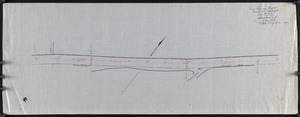
Start Over
Save Search
Your search:
More Like
commonwealth:dz010x843
✖
Remove constraint More Like: commonwealth:dz010x843
« Prev.
|
21
-
40
of
227
|
Next »
Sort
by relevance
relevance
title
date (asc)
date (desc)
recently added
Number of results to display per page
20
per page
per page
10
per page
20
per page
50
per page
100
per page
View results as:
List
list view
Maps
map view
Gallery
grid view
Search Results
21.
Long Beach or Cape Pond Landing
22.
Long Cove and adjacent roads
23.
Lots along beach
24.
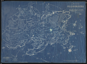
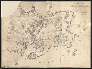
Map of Gloucester, Cape Ann : Showing the roads, harbours, rivers, coves, islands & ledges, surrounding that important cape,...
25.
Map of Gloucester, Cape Ann : Showing the roads, harbours, rivers, coves, islands & ledges, surrounding that important cape,...
26.
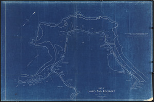
Map of Land's End, Rockport
27.
Map of road between Thos. Oake's old house and land of E. Rowe's heirs
28.
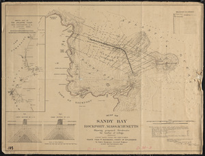
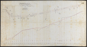
Map of Sandy Bay, Rockport, Massachusetts, showing proposed breakwater for harbor of refuge
29.
Mass. highway layout, Great Hill, Rockport
30.
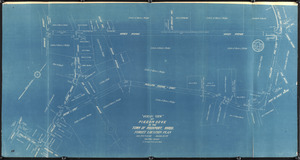
"Ocean View" at Pigeon Cove in Town of Rockport, Mass., street location plan
31.
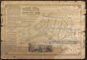
Ocean View, extreme end of Cape Ann, Pigeon Cove, Mass.
32.
Old Garden and Straitsmouth Cove Landing
33.
Part of Town of Rockport showing proposed locations on South St. and Wessex Rd.
34.
Pasture around Ruthern Way & Penzance Road Area
35.
Pigeon Hill St.
36.
Pillion Rocks
37.
Plan & elevations, walk & steps to town landing, Rockport, Mass.
38.
Plan & profile of 12 inch drain on Broadway, Rockport
39.
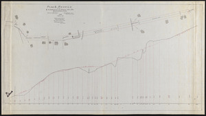
Plan & profile of extension to Pigeon Hill St., Rockport, Mass.
40.
Plan & profile of extension to Pigeon Hill St., Rockport, Mass.
« Previous
Next »
1
2
3
4
5
6
…
11
12
Limit your search
Subject
Streets
76
Sewers
7
Beaches
6
Parks
6
Retaining walls
6
Piers & wharves
4
Land use
3
Bays (Bodies of water)
2
more
Subject
»
Place
Essex (county)
227
Massachusetts
227
North and Central America
227
United States
227
Rockport
186
Pigeon Cove
20
Pool Hill
7
Gloucester
4
more
Place
»
Format
Maps/Atlases
219
Manuscripts
100
Prints
5
Documents
1
Drawings/Illustrations
1
Photographs
1
Available to use
No known restrictions
227
Date
View distribution
Current results range from
1823
to
1974
Date range begin
Date range end
View larger »
Collection
Rockport Town Clerk, Street, Roads and Maps
227
Institution
Town of Rockport
227
We'd love your feedback!
×
Would you be interested in taking a short survey about Digital Commonwealth?