Skip to search
Skip to main content
Skip to first result
Digital Commonwealth
Folders
Sign Up / Log In
Search for
Search
Search
Search
Basic
Advanced
Explore
Map
Collections
Institutions
Formats
For Educators
Primary Source Sets
Lesson Plans
Using Primary Sources
Searching Digital Commonwealth
For Institutions
Join Digital Commonwealth
Conferences, Trainings, & Events
How to Contribute Collections
Digitization Services
Board & Committees
Frequently Asked Questions
About
About Digital Commonwealth
News & Announcements
Copyright & Terms of Use
Harmful Content Statement
Partners
API
Contact Us
Search
Search Constraints
Start Over
Save Search
Your search:
More Like
commonwealth:qv33sz946
✖
Remove constraint More Like: commonwealth:qv33sz946
« Prev.
|
421
-
440
of
647
|
Next »
Sort
by relevance
relevance
title
date (asc)
date (desc)
recently added
Number of results to display per page
20
per page
per page
10
per page
20
per page
50
per page
100
per page
View results as:
List
list view
Maps
map view
Gallery
grid view
Search Results
421.
Slab City II 1932 Stand Map
422.
Slab City II 1933 Stand Map
423.
Slab City II 1936 Stand Map
424.
Slab City II 1937 Stand Map
425.
Slab City II Stand Map 1924, 1925-26-27
426.
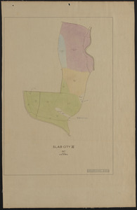
Slab City III 1924-25, 1926 Stand Map
427.
Slab City III 1927 Stand Map
428.
Slab City III 1932 Stand Map
429.
Slab City III 1937 Stand Map
430.
Slab City IV 1924, 1925-26-27 Stand Map
431.
Slab City IV 1930 Stand Map
432.
Slab City IV 1937 Stand Map
433.
Slab City IX 1924-25 stand map
434.
Slab City IX 1931 stand map
435.
Slab City IX 1937 stand map
436.
Slab City IX and X stand maps 1912, 1919, 1927, 1937, 1946, 1956
437.
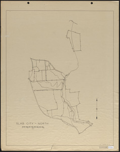
Slab City North
438.
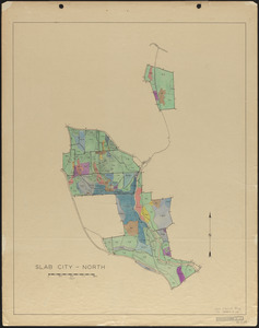
Slab City North 1937 Stand Map
439.
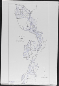
Slab City Soils
440.
Slab City Soils Map - 1940
« Previous
Next »
1
2
…
18
19
20
21
22
23
24
25
26
…
32
33
Limit your search
Subject
Boundaries
151
Forest operations
47
1937
44
1938
41
Hurricanes
37
Land use
37
1946
31
Forest Operations
26
more
Subject
»
Place
North and Central America
647
United States
647
Massachusetts
623
Worcester (county)
596
Petersham
587
Tom Swamp
158
Prospect Hill
153
Tom Swamp Tract
97
more
Place
»
Format
Maps/Atlases
646
Manuscripts
4
Photographs
1
Available to use
Creative Commons license
647
Date
View distribution
Current results range from
1755
to
2016
Date range begin
Date range end
View larger »
Collection
The Harvard Forest Map Collection
647
Institution
Harvard University
647
We'd love your feedback!
×
Would you be interested in taking a short survey about Digital Commonwealth?