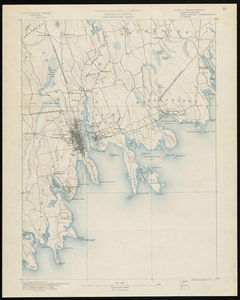
Coastal map of New Bedford, Dartmouth, North Dartmouth, Fairhaven, Mattapoisett, Rochester. Includes railroads, light houses, coastal islands, and necks and points. Relief is shown by contours, isolines and spot heights. The contour interval is 20 feet. Surveyed in 1885.