Skip to search
Skip to main content
Digital Commonwealth
Sign Up / Log In
Search for
Search
Search
Search
Basic
Advanced
Explore
Map
Collections
Institutions
Formats
For Educators
Primary Source Sets
Lesson Plans
Using Primary Sources
Searching Digital Commonwealth
For Institutions
Join Digital Commonwealth
Conferences, Trainings, & Events
How to Contribute Collections
Digitization Services
Board & Committees
Frequently Asked Questions
About
About Digital Commonwealth
News & Announcements
Copyright & Terms of Use
Harmful Content Statement
Partners
API
Contact Us
Boston Public Library
Norman B. Leventhal Map & Education Center Collection
/
Urban Maps (Collection of Distinction)
/
Boston and New England Maps (Collection of Distinction)
/
Applied Geographics, Inc. Records
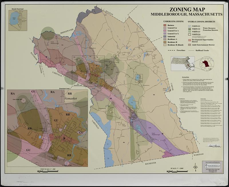
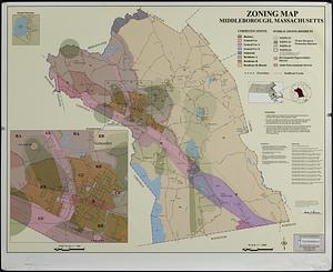
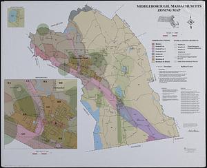
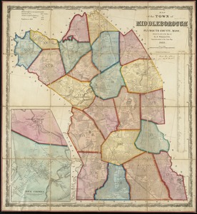
Middleborough, Massachusetts, zoning map
Viewing image 1 of 2
Next >
Middleborough, Massachusetts, zoning map
×
Next
Item Information
Title:
Middleborough, Massachusetts, zoning map
Cartographer:
Applied Geographics, Inc.
Name on Item:
Applied Geographics, Inc.
Date:
2001
Format:
Maps/Atlases
Location:
Boston Public Library
Norman B. Leventhal Map & Education Center
Collection (local):
Applied Geographics, Inc. Records
Subjects:
Middleborough (Mass. : Town)--Maps
Zoning--Massachusetts--Middleborough (Town)--Maps
Electric lines--Massachusetts--Middleborough (Town)--Maps
Railroads--Massachusetts--Middleborough (Town)--Maps
Places:
Massachusetts
>
Plymouth (county)
>
Middleboro
Extent:
1 map : color ; 84 x 108 cm
Permalink:
https://ark.digitalcommonwealth.org/ark:/50959/0k22bc19c
Terms of Use:
No known copyright restrictions.
No known restrictions on use.
Publisher:
[Boston] : Applied Geographics, Inc.
Scale:
Scale approximately 1:24,000
Language:
English
Notes:
Also shows power lines and railroad tracks.
Insets: Woods Pond -- Downtown
Includes notes and location map.
"Revised by Applied Geographics, Inc. on April 2, 2001 and voted at 2001 annual town meeting on May 14, 2001."
Identifier:
06_01_019003
Call #:
AppGeo Folder 7 no. 9-10
Barcode:
30000008057178
show more...
View MODS XML
More Like This
Map of the town of Middleborough : Plymouth Co. Mass. : from ...
Map of the town of Middleborough, Plymouth County, Mass : surveyed ...
Town of Middleborough, Mass
1985 land use in the Mass. Turnpike corridor
Find More Like This >>
Tools
Share
Facebook
Pinterest
X
Reddit
Tumblr
Email
Copy link
Add to Folder
Questions/Comments
Cite This Item
IIIF Manifest
Downloads
Primary (full resolution, uncompressed)
(TIF, multi-file ZIP, 869 MB)
Large (full resolution)
(JPEG, multi-file ZIP, 7.38 MB)
Medium
(JPEG, multi-file ZIP, 190 KB)