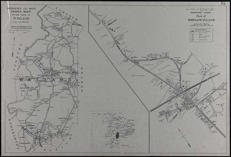
Middlesex Co. Mass., index map to the town of Wayland : Middlesex County, part of Town of Wayland
Middlesex Co. Mass., index map to the town of Wayland
Item Information
Title:
Middlesex Co. Mass., index map to the town of Wayland : Middlesex County, part of Town of Wayland
Description:
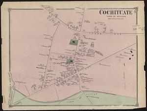
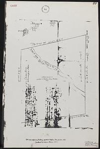
Three maps from the Atlas of Middlesex County Vol. III: Town of Wayland, also index map (Vol.3) showing Wayland in relation to nearby communities; and a part of the Town of Wayland showing parts of Main St., Concord Rd., Crescent Street, Bridle Road, State Road (today Main St, north is Old Sudbury Road, Main Street south is Cochituate Road, Crescent Street is Bow Road and Bridle is Pelham Island Road). Shows property owners' names, buildings, stables, hydrants and water pipes, and railroad and railroad station, churches, town hall, school and the International Order of Odd Fellows. A full map of the town of Wayland is the third map and it shows the roads and the names of the larger property owners but not the Cochituate section of town which is on another page.
Title from item or accompanying material.
Scale note 1 inch = 2500 feet and 1 inch = 200 feet.
Massachusetts Middlesex County 1908 Vol.3 -- Geo. H. Walker & Co.
Notes (date):
Date from item or accompanying material.
Notes (object):
This item is a copy on translucent vellum of the 1908 original.