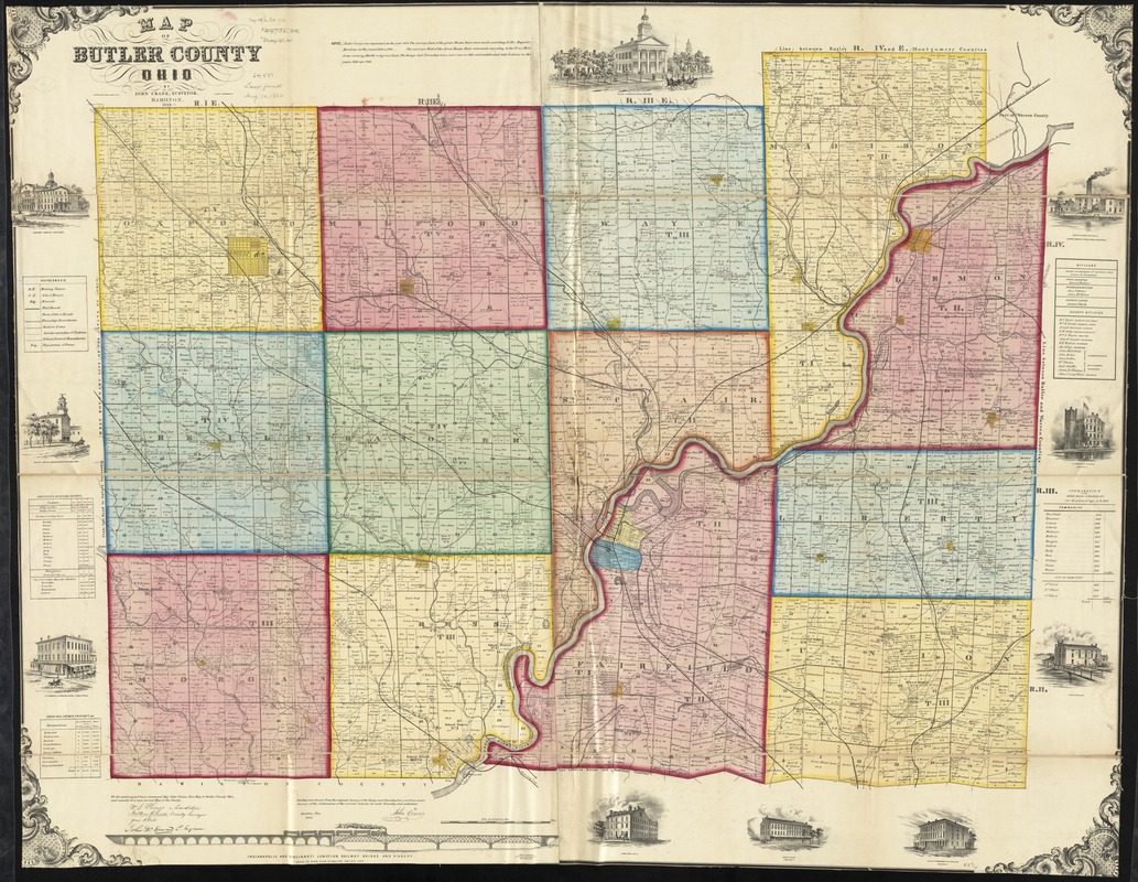
This map was drawn from the original surveys of the range and township lines and from recent surveys of the subdivision fo the several sections in each township and published by John Crane.
BPL copy assembled, sectioned in 4 pieces and mounted on cloth.
Includes statistical table, list of church properties, list of county officers, population list, illustration of the Indianapolis and Cincinnati Junction Railway bridge and viaduct and 10 views of public and commercial properties.