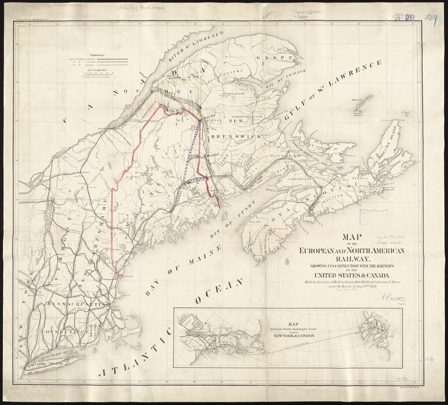
Map of the European and North American Railway, showing its connection with the railways of the United States & Canada; made by direction of His Excellency John Hubbard, Governor of Maine under the resolve of Aug. 20th 1850
Map of the European and North American Railway, showing its connection with the railways of the United States & Canada; made by direction of His Excellency John Hubbard, Governor of Maine under the resolve of Aug. 20th 1850
Item Information
Title:
Map of the European and North American Railway, showing its connection with the railways of the United States & Canada; made by direction of His Excellency John Hubbard, Governor of Maine under the resolve of Aug. 20th 1850
Description:
Shows New England, eastern New York, and the Maritime Provinces. Gives completed, in progress, and proposed railroads. Indicates drainage, state boundaries, and larger cities. Slightly different edition, engraved by B.W. Thayer & Co., Boston, accompanies Morton's Report on the Survey of the European and North American Railway ... in Documents in Relation to the European and North American Railway Company ... (Portland, Harmon and Williams, 1851).