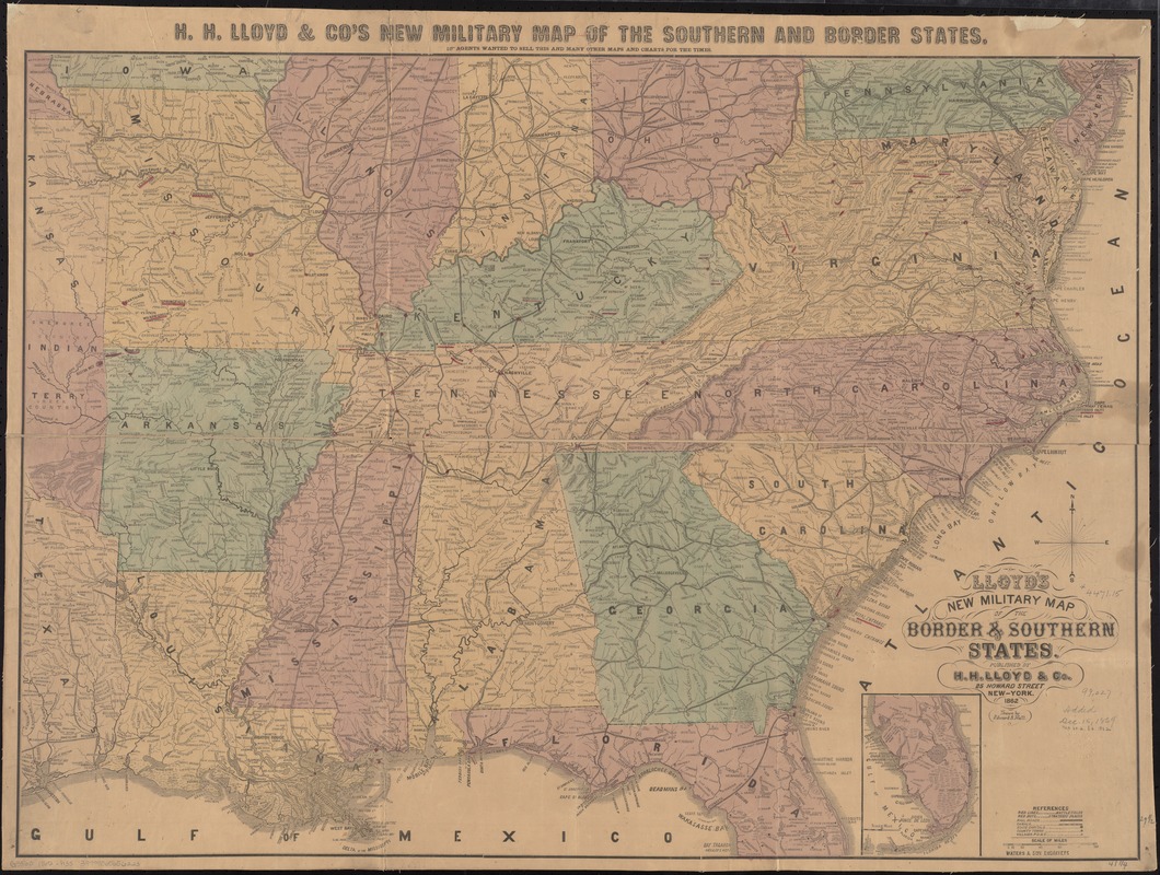
Relief shown by hachures.
At top of map: H.H. Lloyd & Co's. new military map of the southern and border states. Agents wanted to sell this and m[an]y other maps and charts for the times.
Inset: [Southern Florida].
Battlefields are marked by red lines and strategic places by red dots.
Indicates towns, railroads, rivers, names and boundaries of states, and relief by hachures.
Corinth, Mississippi, is incorrectly identified as Farmington in this issue.
1863 edition listed as Civil War Maps entry no. 38 and 1865 edition as Civil War Maps entry no. 71.
Description derived from published bibliography.