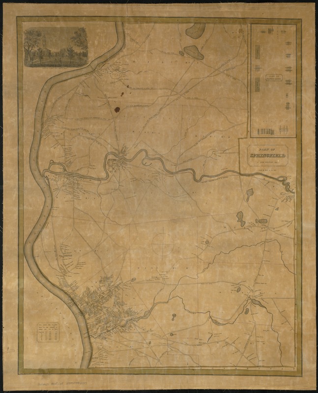
Partial cadastral map with names of landowners, districts numbered and colored.
Covers the City of Springfield and the Town of Chicopee, Massachusetts.
Includes engraving by R. O'Brien from a sketch by Elwell.
Population chart in lower left corner with text: First settled May 25 1636. Burnt by the Indians in Phillips War Oct. 16, 1675.
Inset: Plan of Franklin Square.
Plan of Franklin Square shows points of interest.