Skip to search
Skip to main content
Digital Commonwealth
Sign Up / Log In
Search for
Search
Search
Search
Basic
Advanced
Explore
Map
Collections
Institutions
Formats
For Educators
Primary Source Sets
Lesson Plans
Using Primary Sources
Searching Digital Commonwealth
For Institutions
Join Digital Commonwealth
Conferences, Trainings, & Events
How to Contribute Collections
Digitization Services
Board & Committees
Frequently Asked Questions
About
About Digital Commonwealth
News & Announcements
Copyright & Terms of Use
Harmful Content Statement
Partners
API
Contact Us
Boston Public Library
Norman B. Leventhal Map & Education Center Collection
/
David Judkins Weaver Papers
/
Boston and New England Maps (Collection of Distinction)
Massachusetts shoreline change summary map
Massachusetts shoreline change summary map
×
Item Information
Title:
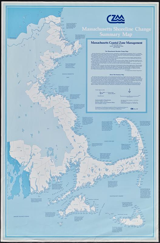
Massachusetts shoreline change summary map
Cartographer:
Harris, Cynthia, 1957-
Issuing body:
Massachusetts Coastal Zone Management Office
Name on Item:
map design and data compilation, Cynthia Harris
Date:
[1989]
Format:
Maps/Atlases
Location:
Boston Public Library
Norman B. Leventhal Map & Education Center
Collection (local):
David Judkins Weaver Papers
Subjects:
Atlantic Coast (Mass.)--Maps
Shorelines--Massachusetts--Atlantic Coast--Maps
Coast changes--Massachusetts--Atlantic Coast--Maps
Places:
Massachusetts
Extent:
1 map : color ; 97 x 62 cm
Permalink:
https://ark.digitalcommonwealth.org/ark:/50959/8910q703w
Terms of Use:
No known copyright restrictions.
No known restrictions on use.
Publisher:
[Boston] : Massachusetts Coastal Zone Management
Scale:
Scale approximately 1:211,200
Language:
English
Notes:
"May 1989."
Shows advance or retreat of shoreline in feet at various locations for given time intervals.
Includes text and descriptive notes on shoreline and changes in it.
Notes (date):
This date is inferred.
Identifier:
06_01_018809
Call #:
Weaver folder 12 no. 8
show more...
View MODS XML
More Like This
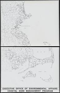
Outline map of towns on the Massachusetts coast
From Muskeget Channel to Buzzard's Bay and entrance to Vineyard ...
From Muskeget Channel to Buzzard's Bay and entrance to Vineyard ...
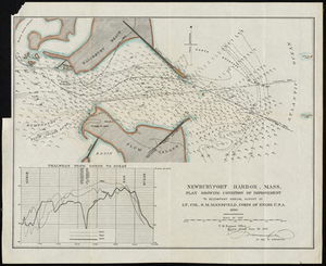
Newburyport Harbor, Mass. Plan Showing Condition of Improvement
Find More Like This >>
Tools
Share
Facebook
Pinterest
X
Reddit
Tumblr
Email
Copy link
Add to Folder
Questions/Comments
Cite This Item
IIIF Manifest
Downloads
Primary (full resolution, uncompressed)
(TIF, 380 MB)
Large (full resolution)
(JPEG, 31.9 MB)
Medium
(JPEG, 84.2 KB)