Skip to search
Skip to main content
Digital Commonwealth
Sign Up / Log In
Search for
Search
Search
Search
Basic
Advanced
Explore
Map
Collections
Institutions
Formats
For Educators
Primary Source Sets
Lesson Plans
Using Primary Sources
Searching Digital Commonwealth
For Institutions
Join Digital Commonwealth
Conferences, Trainings, & Events
How to Contribute Collections
Digitization Services
Board & Committees
Frequently Asked Questions
About
About Digital Commonwealth
News & Announcements
Copyright & Terms of Use
Harmful Content Statement
Partners
API
Contact Us
Lucius Beebe Memorial Library
Lucius Beebe Memorial Library Historic Maps
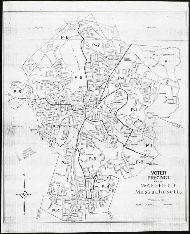
Voter precinct map of Wakefield, Massachusetts
Voter precinct map of Wakefield, Massachusetts
×
Item Information
Title:
Voter precinct map of Wakefield, Massachusetts
Name on Item:
compiled by the Department of Public Works, Engineering division
Date:
1992
Format:
Maps/Atlases
Location:
Lucius Beebe Memorial Library
Collection (local):
Lucius Beebe Memorial Library Historic Maps
Subjects:
Election districts
Places:
Middlesex (county)
>
Wakefield
Extent:
1 map : b&w ; 53 x 45 cm.
Permalink:
https://ark.digitalcommonwealth.org/ark:/50959/c534g365f
Terms of Use:
No known copyright restrictions.
No known restrictions on use.
Publisher:
Wakefield, MA : Dept. of Public Works
Scale:
Scale 1:6,000
Language:
English
Notes:
Map depicts entire town of Wakefield in 1992, showing the six voter precincts, as well as streets, schools, and other major public buildings.
Call #:
Local History Map Case Wakefield 1992-1
Barcode:
31392003576810
show more...
View MODS XML
More Like This
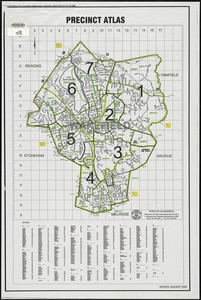
Precinct atlas, Town of Wakefield
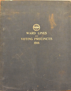
1916
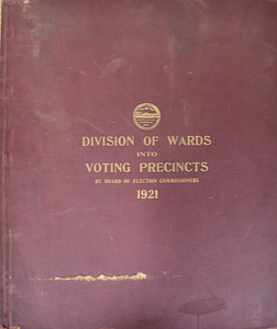
1921
1925
Find More Like This >>
Tools
Share
Facebook
Pinterest
X
Reddit
Tumblr
Email
Copy link
Add to Folder
Questions/Comments
Cite This Item
IIIF Manifest
Downloads
Primary (full resolution, uncompressed)
(TIF, 103 MB)
Large (full resolution)
(JPEG, 8.66 MB)
Medium
(JPEG, 227 KB)