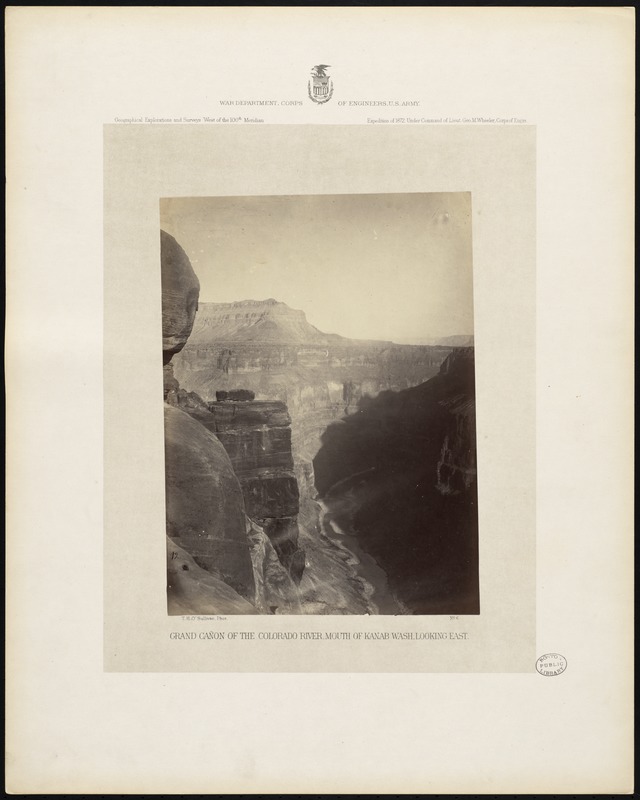
Grand Cañon of the Colorado River, mouth of Kanab Wash, looking east
Item Information
- Title:
- Grand Cañon of the Colorado River, mouth of Kanab Wash, looking east
- Description:
-
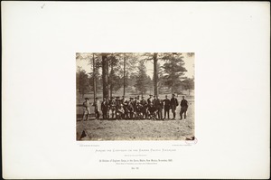
Descriptive legend of view no. 6: The Kanab Cañon, after running due south for nearly a hundred miles, joins the Colorado at about the middle point of the Grand Canon proper. Standing at the mouth of the Kanab and looking eastward up the Colorado, the canon is seen in all the majesty of its grandest type. Above the river-bed the boundary walls rise a mile or more in height, sometimes abrupt and overhanging, again receding in benches or terraces which are gigantic stairs climbing to the surrounding plateaus. Successive sheets of marble, granite, shale, limestone, and sandstone, whose courses of a thousand feet in thickness are distorted by folds and broken by faults, crop out along the ledges and stripe them all with hues of red, black, brown, and gray. The edge of the adjacent mesa, or table-land, is ragged with the numerous lateral washes, or gulches, whose channels wind through dark recesses which are sombre with the shadows of the impending cornices of stone. At the foot of the walls lie slopes of variegated and fragmentary rock which the winter frosts have chipped from the cliffs above. Through this black abyss the river runs like a silver thread, so far in the depths that the roaring of its cataracts is lost to the listener who stands above. In the early ages of geology, however, this canal was more shallow than now, and the river washed those bowlders which are seen in the front of the picture, rounding them into their present shape.
- Photographer:
- Bell, William, 1830-1910
- Photographer:
- O'Sullivan, Timothy H., 1840-1882
- Publisher:
- United States. War Department. Corps of Engineers
- Date:
-
[1872]
(created)
[1876] (issued)
- Format:
-
Photographs
- Genre:
-
Albumen prints
Expedition photographs
- Location:
-
Boston Public Library
Arts Department - Collection (local):
-
Photographs of the American West
- Series:
- Photographs From Explorations and Surveys West of the 100th Meridian Photographs from geographical explorations and surveys west of the 100th meridian, expeditions of 1871, 1872, 1873, and 1874, with descriptive text - under command of Lieut. Geo. M. Wheeler, Corps of Engrs
- Places:
-
ArizonaGrand Canyon (area)
ArizonaCoconino (county)Kanab Canyon (area)
- Extent:
- 1 photographic print : albumen ; image 28 x 21 cm., on mount 51 x 41 cm.
- Permalink:
- https://ark.digitalcommonwealth.org/ark:/50959/cf95jc31x
- Terms of Use:
-
 No Copyright - United States
No known copyright restrictions.
No known restrictions on use.