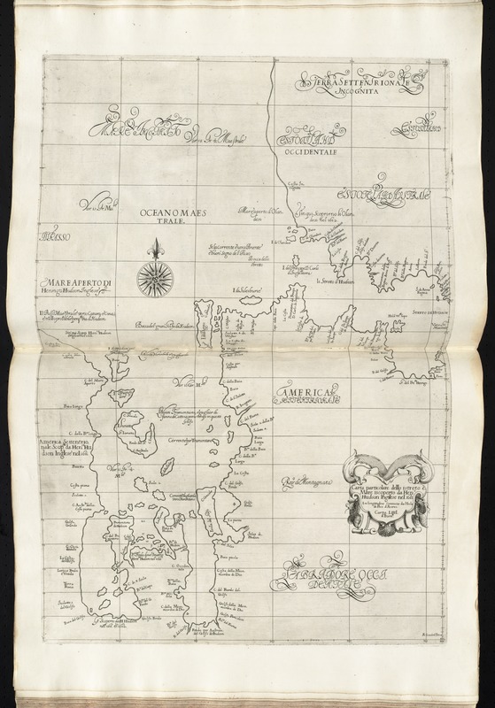
Carta particolare dello istreto e mare iscoperto de Hen. Hudson Ingilese nel. 1611
Carta particolare dello istreto e mare iscoperto de Hen. Hudson Ingilese nel. 1611
Item Information
Title:
Carta particolare dello istreto e mare iscoperto de Hen. Hudson Ingilese nel. 1611
Description:
The first printed sea chart of Hudson Bay and Hudson strait, it shows coastal towns, prevailing winds, ocean currents, and magnetic deviations of the compass.
Covers Hudson Bay and part of Hudson strait, showing coastal towns, harbours and islands.
Prime meridian: Pico.
"Carta LIIII d' Euroa."
In Dudley's Dell'arcano del mare, 1646-1647.
Cataloging, conservation, and digitization made possible in part by The National Endowment for the Humanities: Exploring the human endeavor.
![[Chart of the coast of Quebec from the Riviere St. Jean to Grand Hermine Bay]](https://bpldcassets.blob.core.windows.net/derivatives/images/commonwealth:7h149v50v/image_thumbnail_300.jpg)


