Skip to search
Skip to main content
Digital Commonwealth
Sign Up / Log In
Search for
Search
Search
Search
Basic
Advanced
Explore
Map
Collections
Institutions
Formats
For Educators
Primary Source Sets
Lesson Plans
Using Primary Sources
Searching Digital Commonwealth
For Institutions
Join Digital Commonwealth
Conferences, Trainings, & Events
How to Contribute Collections
Digitization Services
Board & Committees
Frequently Asked Questions
About
About Digital Commonwealth
News & Announcements
Copyright & Terms of Use
Harmful Content Statement
Partners
API
Contact Us
Boston Public Library
Norman B. Leventhal Map & Education Center Collection
/
Maritime Charts and Atlases (Collection of Distinction)
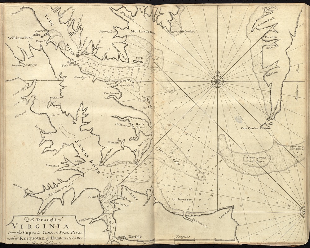
A draught of Virginia from the Capes to York in York River and to Kuiquotan or Hamton in James River
A draught of Virginia from the Capes to York in York River and to Kuiquotan or Hamton in James River
×
Item Information
Title:
A draught of Virginia from the Capes to York in York River and to Kuiquotan or Hamton in James River
Creator:
Tiddeman, Mark.
Name on Item:
by Mark Tiddeman.
Date:
[1737]
Format:
Maps/Atlases
Location:
Boston Public Library
Norman B. Leventhal Map & Education Center
Collection (local):
Norman B. Leventhal Map & Education Center Collection
Subjects:
Nautical charts--Chesapeake Bay (Md. and Va.)--Early works to 1800
Coasts--Virginia--Maps--Early works to 1800
Chesapeake Bay (Md. and Va.)--Maps--Early works to 1800
Maryland--Maps--Early works to 1800
Virginia--Maps--Early works to 1800
Places:
Chesapeake Bay
Virginia
Extent:
1 map ; 46 x 58 cm.
Permalink:
https://ark.digitalcommonwealth.org/ark:/50959/cj82m5117
Terms of Use:
No known copyright restrictions.
No known restrictions on use.
Publisher:
London : Printed & sold by Page and Mount
Scale:
Scale [ca. 1:125,000]
Language:
English
Notes:
Depths shown by soundings.
In the English pilot, the fourth book. London : Printed for William Mount and Thomas Page, 1737.
Notes (date):
This date is inferred.
Identifier:
06_01_010269
Call #:
G1106.P5 E54 1737
Barcode:
30000003249886
show more...
View MODS XML
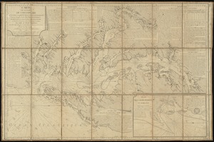
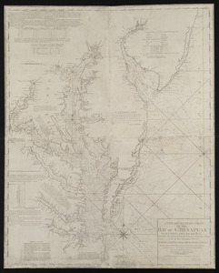
More Like This
Virginia, Maryland, Pennsilvania, east & west New Jarsey
Chart of the coast of America from Cape Henry to Albermarle Sound
Carte de la baie de Chesapeake et de la partie navigable des ...
A new and accurate chart of the Bay of Chesapeak including ...
Find More Like This >>
Tools
Share
Facebook
Pinterest
X
Reddit
Tumblr
Email
Copy link
Add to Folder
Questions/Comments
Cite This Item
IIIF Manifest
Downloads
Primary (full resolution, uncompressed)
(TIF, 104 MB)
Large (full resolution)
(JPEG, 8.76 MB)
Medium
(JPEG, 320 KB)
We'd love your feedback!
×
Would you be interested in taking a short survey about Digital Commonwealth?