Skip to search
Skip to main content
Digital Commonwealth
Sign Up / Log In
Search for
Search
Search
Search
Basic
Advanced
Explore
Map
Collections
Institutions
Formats
For Educators
Primary Source Sets
Lesson Plans
Using Primary Sources
Searching Digital Commonwealth
For Institutions
Join Digital Commonwealth
Conferences, Trainings, & Events
How to Contribute Collections
Digitization Services
Board & Committees
Frequently Asked Questions
About
About Digital Commonwealth
News & Announcements
Copyright & Terms of Use
Harmful Content Statement
Partners
API
Contact Us
Boston Public Library
Norman B. Leventhal Map & Education Center Collection
/
Urban Maps (Collection of Distinction)
/
Boston and New England Maps (Collection of Distinction)
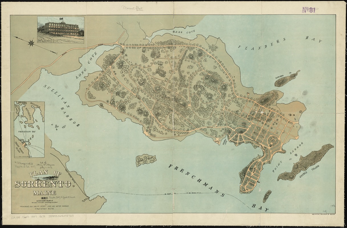
Plan of Sorrento, Maine
Plan of Sorrento, Maine
×
Item Information
Title:
Plan of Sorrento, Maine
Creator:
Grundel, Hermann.
Name on Item:
Hermann Grundel, landscape architect.
Date:
1887
Format:
Maps/Atlases
Location:
Boston Public Library
Norman B. Leventhal Map & Education Center
Collection (local):
Norman B. Leventhal Map & Education Center Collection
Subjects:
Sorrento (Me.)--Maps
Places:
Maine
>
Hancock (county)
>
Sorrento
Extent:
1 map : col. ; 45 x 74 cm.
Permalink:
https://ark.digitalcommonwealth.org/ark:/50959/cj82m711n
Terms of Use:
No known copyright restrictions.
No known restrictions on use.
Publisher:
Boston : Frenchman's Bay and Mt. Desert Land and Water Company
Scale:
Scale [ca. 1:10,000]
Language:
English
Notes:
Oriented with north to the upper left.
Relief shown by hachures.
Inset: [Location map of the surrounding area].
Includes view of The Waukeag House.
Identifier:
06_01_010446
Call #:
G3734.S645 1887 .G78
Barcode:
39999065672725
show more...
View MODS XML
More Like This
The 100th anniversary map of Abraham Lincoln's visit to ...
1630 shoreline
1879. Progress map of the U.S. Geographical Surveys west of the ...
1903 Map of Salem and surrounding places
Find More Like This >>
Tools
Share
Facebook
Pinterest
X
Reddit
Tumblr
Email
Copy link
Add to Folder
Questions/Comments
Cite This Item
IIIF Manifest
Downloads
Primary (full resolution, uncompressed)
(TIF, 181 MB)
Large (full resolution)
(JPEG, 15.2 MB)
Medium
(JPEG, 308 KB)
GeoTIFF (georeferenced)
(TIF, 314 MB)