Skip to search
Skip to main content
Digital Commonwealth
Sign Up / Log In
Search for
Search
Search
Search
Basic
Advanced
Explore
Map
Collections
Institutions
Formats
For Educators
Primary Source Sets
Lesson Plans
Using Primary Sources
Searching Digital Commonwealth
For Institutions
Join Digital Commonwealth
Conferences, Trainings, & Events
How to Contribute Collections
Digitization Services
Board & Committees
Frequently Asked Questions
About
About Digital Commonwealth
News & Announcements
Copyright & Terms of Use
Harmful Content Statement
Partners
API
Contact Us
Boston Public Library
Norman B. Leventhal Map & Education Center Collection
/
David Judkins Weaver Papers
/
Boston and New England Maps (Collection of Distinction)
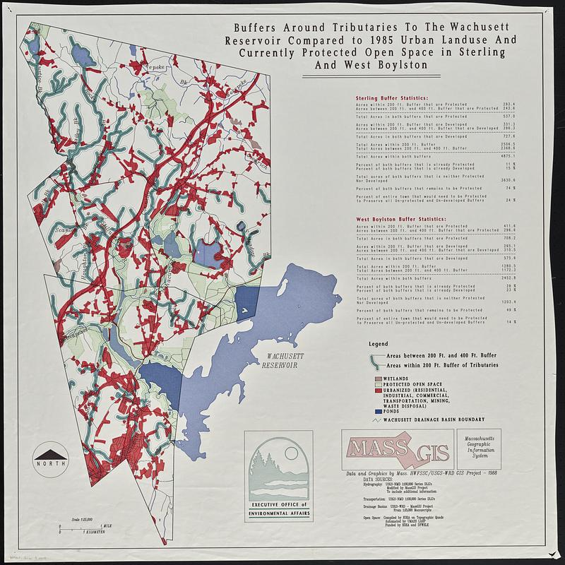
Buffers around tributaries to the Wachusett Reservoir compared to 1985 urban landuse and currently protected open space in Sterling and West Boylston
Buffers around tributaries to the Wachusett Reservoir compared to 1985 urban landuse and currently protected open space in Sterling and West Boylston
×
Item Information
Title:
Buffers around tributaries to the Wachusett Reservoir compared to 1985 urban landuse and currently protected open space in Sterling and West Boylston
Cartographer:
MassGIS (Office : Mass.)
Cartographer:
Massachusetts. Executive Office of Environmental Affairs
Name on Item:
data and graphics by Mass. HWFSSC/USGS-WRD GIS project ; Executive Office of Environmental Affairs
Date:
1988
Format:
Maps/Atlases
Location:
Boston Public Library
Norman B. Leventhal Map & Education Center
Collection (local):
David Judkins Weaver Papers
Subjects:
Wachusett Reservoir (Mass.)--Maps
Wachusett Reservoir Region (Mass.)--Maps
Watersheds--Massachusetts--Wachusett Reservoir--Maps
Land use--Massachusetts--Wachusett Reservoir--Maps
Land use--Massachusetts--Boylston (Town)--Maps
Land use--Massachusetts--Sterling (Town)--Maps
Open spaces--Massachusetts--Wachusett Reservoir--Maps
Open spaces--Massachusetts--Boylston (Town)--Maps
Open spaces--Massachusetts--Sterling (Town)--Maps
Places:
Massachusetts
>
Worcester (county)
>
Wachusett Reservoir
Massachusetts
>
Worcester (county)
>
Boylston
Massachusetts
>
Worcester (county)
>
Sterling
Extent:
1 map : color ; 82 x 81 cm
Permalink:
https://ark.digitalcommonwealth.org/ark:/50959/cr56sd116
Terms of Use:
No known copyright restrictions.
No known restrictions on use.
Publisher:
[Boston] : Executive Office of Environmental Affairs
Scale:
Scale 1:25,000
Language:
English
Notes:
Includes buffer statistics.
Identifier:
06_01_018825
Call #:
Weaver folder 9 no. 4
show more...
View MODS XML
More Like This
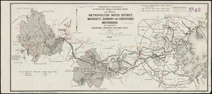
Map showing metropolitan water district, Wachusett, Sudbury and ...
The 1976 proposed regional open space plan
Airbrush base for the Pelorus Linea region of Europa
Aitoff's equal area projection of the sphere
Find More Like This >>
Tools
Share
Facebook
Pinterest
X
Reddit
Tumblr
Email
Copy link
Add to Folder
Questions/Comments
Cite This Item
IIIF Manifest
Downloads
Primary (full resolution, uncompressed)
(TIF, 411 MB)
Large (full resolution)
(JPEG, 34.5 MB)
Medium
(JPEG, 155 KB)