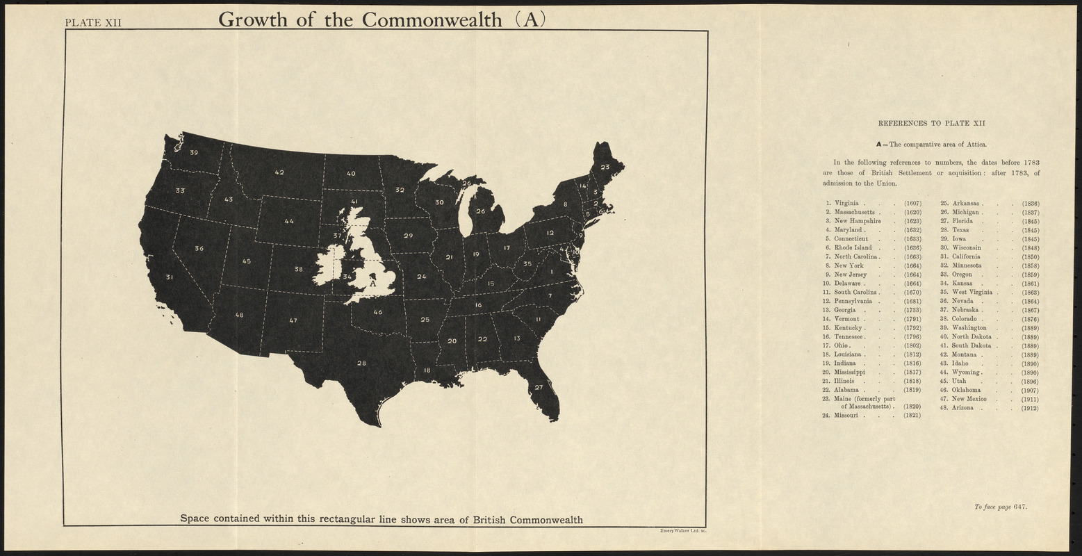
Shows relative size of the British Isles overlaid on a map of the United States.
Includes references.
Appears in The commonwealth of nations / edited by L. Curtis.
"Plate XII."
"To face page 647."
Notes (exhibitions):
Exhibited: "Bending lines: maps and data from distortion to deception," organized by the Norman B. Leventhal Map & Education Center at the Boston Public Library, 2020-2021.