Skip to search
Skip to main content
Digital Commonwealth
Sign Up / Log In
Search for
Search
Search
Search
Basic
Advanced
Explore
Map
Collections
Institutions
Formats
For Educators
Primary Source Sets
Lesson Plans
Using Primary Sources
Searching Digital Commonwealth
For Institutions
Join Digital Commonwealth
Conferences, Trainings, & Events
How to Contribute Collections
Digitization Services
Board & Committees
Frequently Asked Questions
About
About Digital Commonwealth
News & Announcements
Copyright & Terms of Use
Harmful Content Statement
Partners
API
Contact Us
Boston Public Library
Norman B. Leventhal Map & Education Center Collection
/
Urban Maps (Collection of Distinction)
/
David Judkins Weaver Papers
/
Boston and New England Maps (Collection of Distinction)
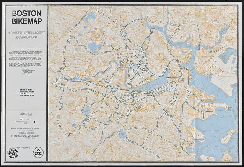
Boston bikemap : toward intelligent commuting
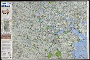
Boston bikemap
×
Item Information
Title:
Boston bikemap : toward intelligent commuting
Cartographer:
Weaver, David Judkins, 1951-
Publisher:
Metropolitan Planning Organization (Mass.). Central Transportation Planning Staff
Contributor:
Urban Bikeway Design Collaborative
Name on Item:
a project of Urban Bikeway Design Collaborative ; coordinator Duff Bailey ; director John Troja ; cartographer David Weaver
Date:
[ca. 1970–1979]
Format:
Maps/Atlases
Location:
Boston Public Library
Norman B. Leventhal Map & Education Center
Collection (local):
David Judkins Weaver Papers
Subjects:
Boston (Mass.)--Maps
Bicycle trails--Massachusetts--Boston--Maps
Places:
Massachusetts
>
Suffolk (county)
>
Boston
Extent:
1 map : color ; 56 x 68 cm folded to 20 x 18 cm
Permalink:
https://ark.digitalcommonwealth.org/ark:/50959/ft84f3213
Terms of Use:
No known copyright restrictions.
No known restrictions on use.
Publisher:
[Boston, Mass.] : Central Transportation Planning Agency
Scale:
Scale 1:24,000
Language:
English
Notes:
Relief shown by contours and spot heights. Depths shown by soundings and isolines.
"Base map: U.S.G.S. topographic quads."
Includes text.
Identifier:
06_01_018854
Call #:
Weaver folder 8 no. 1
show more...
View MODS XML
More Like This
Boston's bikemap : Arlington, Belmont, Brookline, Cambridge, ...
Free 1978 Boston bikemap : featuring an illustrated guide to ...
Major thoroughfare system, city of Boston, June 1972
The 1976 proposed regional open space plan
Find More Like This >>
Tools
Share
Facebook
Pinterest
X
Reddit
Tumblr
Email
Copy link
Add to Folder
Questions/Comments
Cite This Item
IIIF Manifest
Downloads
Primary (full resolution, uncompressed)
(TIF, 272 MB)
Large (full resolution)
(JPEG, 22.9 MB)
Medium
(JPEG, 121 KB)