Skip to search
Skip to main content
Digital Commonwealth
Sign Up / Log In
Search for
Search
Search
Search
Basic
Advanced
Explore
Map
Collections
Institutions
Formats
For Educators
Primary Source Sets
Lesson Plans
Using Primary Sources
Searching Digital Commonwealth
For Institutions
Join Digital Commonwealth
Conferences, Trainings, & Events
How to Contribute Collections
Digitization Services
Board & Committees
Frequently Asked Questions
About
About Digital Commonwealth
News & Announcements
Copyright & Terms of Use
Harmful Content Statement
Partners
API
Contact Us
Lawrence Public Library
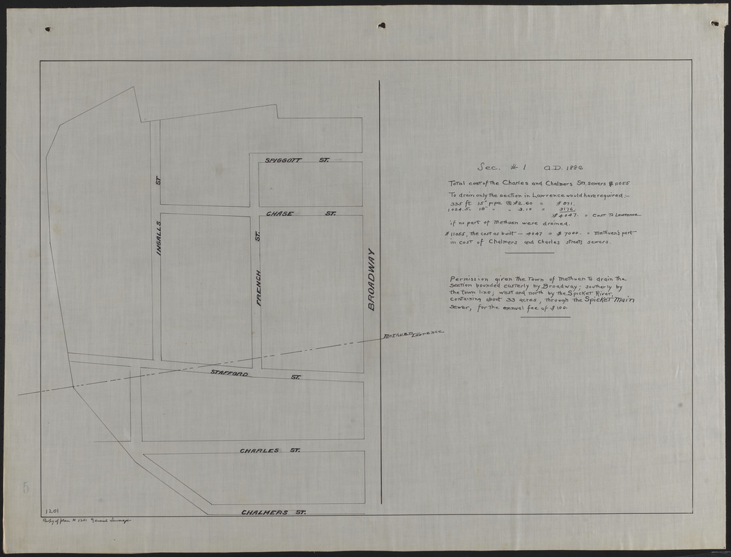
Lawrence, Mass. Engineering Department. City Sewers
Map of land in Lawrence and Methuen drained by Spicket main sewer
Map of land in Lawrence and Methuen drained by Spicket main sewer
×
Item Information
Title:
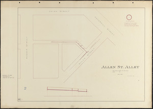
Map of land in Lawrence and Methuen drained by Spicket main sewer
Date:
1886
Format:
Maps/Atlases
Manuscripts
Genre:
Planning drawings
Location:
Lawrence Public Library
Special Collections
Row 2, Tier D, Shelf 11, Vol. 11 (shelf locator)
Collection (local):
Lawrence, Mass. Engineering Department. City Sewers
Subjects:
Sewers
Streets
Places:
Massachusetts
>
Essex (county)
>
Lawrence
Extent:
1 map : ms. ; 46 x 66 cm
Permalink:
https://ark.digitalcommonwealth.org/ark:/50959/gh93j348d
Terms of Use:
No known copyright restrictions.
No known restrictions on use.
Language:
English
Notes:
Title supplied by cataloger.
Preferred Citation:
Courtesy Lawrence Public Library
Notes (date):
Date from item.
Accession #:
2009.9.2.14
Identifier:
1201
Barcode:
31549004280078
show more...
View MODS XML
More Like This
Across Holly Street to the Spicket River
Acton and West Sts.
Acton Street
Allen St. Alley
Find More Like This >>
Tools
Share
Facebook
Pinterest
X
Reddit
Tumblr
Email
Copy link
Add to Folder
Questions/Comments
Cite This Item
Downloads
Primary (full resolution, uncompressed)
(TIF, 243 MB)
Large (full resolution)
(JPEG, 20.4 MB)
Medium
(JPEG, 164 KB)