Skip to search
Skip to main content
Digital Commonwealth
Sign Up / Log In
Search for
Search
Search
Search
Basic
Advanced
Explore
Map
Collections
Institutions
Formats
For Educators
Primary Source Sets
Lesson Plans
Using Primary Sources
Searching Digital Commonwealth
For Institutions
Join Digital Commonwealth
Conferences, Trainings, & Events
How to Contribute Collections
Digitization Services
Board & Committees
Frequently Asked Questions
About
About Digital Commonwealth
News & Announcements
Copyright & Terms of Use
Harmful Content Statement
Partners
API
Contact Us
Boston Public Library
Norman B. Leventhal Map & Education Center Collection
/
Urban Maps (Collection of Distinction)
/
Boston and New England Maps (Collection of Distinction)
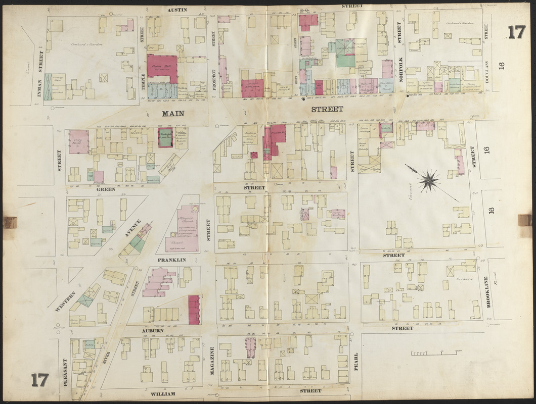
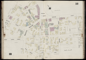
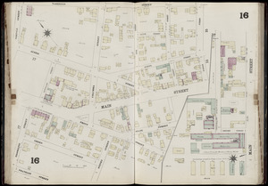
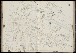
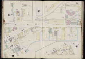
Insurance map of Charlestown : portions of Roxbury (now annexed to Boston) and Cambridge : 1868 : corrected Nov. 1871 : plate 17
Insurance map of Charlestown : portions of Roxbury (now annexed to Boston) and Cambridge : 1868 : corrected Nov. 1871
×
Item Information
Title:
Insurance map of Charlestown : portions of Roxbury (now annexed to Boston) and Cambridge : 1868 : corrected Nov. 1871 : plate 17
Cartographer:
Sanborn, D. A. (Daniel Alfred), -1883
Date:
1871
Format:
Maps/Atlases
Location:
Boston Public Library
Norman B. Leventhal Map & Education Center
Collection (local):
Norman B. Leventhal Map & Education Center Collection
Subjects:
Fire risk assessment--Massachusetts--Cambridge--Maps
Real property--Massachusetts--Cambridge--Maps
Cambridge (Mass.)--Maps
Places:
Massachusetts
>
Middlesex (county)
>
Cambridge
Extent:
1 map : color ; 68 x 91 cm
Permalink:
https://ark.digitalcommonwealth.org/ark:/50959/ht24zw535
Terms of Use:
No known copyright restrictions.
No known restrictions on use.
Publisher:
N.Y. : D.A. Sanborn
Scale:
Scale approximately 1:600
Language:
English
Identifier:
06_01_016579
Call #:
G1234.B6:2C38G475 S2 1871
Barcode:
39999059015436
show more...
View MODS XML
More Like This
Insurance map of Charlestown : portions of Roxbury (now annexed to ...
Insurance map of Charlestown : portions of Roxbury (now annexed to ...
Insurance map of Charlestown : portions of Roxbury (now annexed to ...
Insurance map of Charlestown : portions of Roxbury (now annexed to ...
Find More Like This >>
Tools
Share
Facebook
Pinterest
X
Reddit
Tumblr
Email
Copy link
Add to Folder
Questions/Comments
Cite This Item
IIIF Manifest
Downloads
Primary (full resolution, uncompressed)
(TIF, 210 MB)
Large (full resolution)
(JPEG, 17.6 MB)
Medium
(JPEG, 273 KB)