Skip to search
Skip to main content
Digital Commonwealth
Sign Up / Log In
Search for
Search
Search
Search
Basic
Advanced
Explore
Map
Collections
Institutions
Formats
For Educators
Primary Source Sets
Lesson Plans
Using Primary Sources
Searching Digital Commonwealth
For Institutions
Join Digital Commonwealth
Conferences, Trainings, & Events
How to Contribute Collections
Digitization Services
Board & Committees
Frequently Asked Questions
About
About Digital Commonwealth
News & Announcements
Copyright & Terms of Use
Harmful Content Statement
Partners
API
Contact Us
Phillips Academy
Sidney R. Knafel Map Collection at Phillips Academy
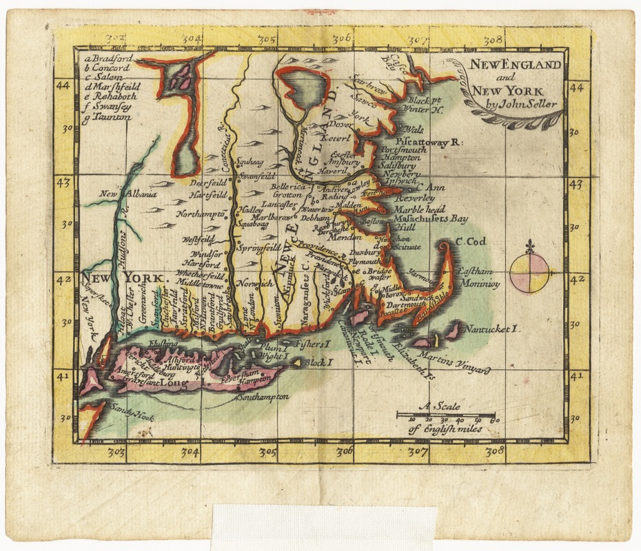
New England and New York
New England and New York
×
Item Information
Title:
New England and New York
Creator:
Seller, John, active 1658-1698
Name on Item:
by John Seller
Date:
[1703]
Format:
Maps/Atlases
Location:
Phillips Academy
Collection (local):
Sidney R. Knafel Map Collection at Phillips Academy, Andover MA
Subjects:
New England--Maps--Early works to 1800
Places:
New England
(area)
Extent:
1 map : hand col. ; 11 x 14 cm., folded to 15 x 8 cm.
Permalink:
https://ark.digitalcommonwealth.org/ark:/50959/j3860859r
Terms of Use:
Rights status not evaluated.
Contact host institution for more information.
Publisher:
[London] : [John Seller]
Scale:
Scale [ca. 1:4,250,000]
Language:
English
Notes:
Relief shown pictorially.
Covers New England from Casco Bay to Staten Island.
Prime meridan: Ferro.
From Seller's New system of geography (London : John Seller, 1703).
Notes (date):
This date is inferred.
Identifier:
1393
show more...
View MODS XML
More Like This
An accurate map of Rhode Island, part of Connecticut and ...
Bowles's new pocket map of the most inhabited part of New England ...
Carte de la Nouvelle Angleterre, New York, Pensilvanie et Nouveau ...
Carte de la Nouvelle Angleterre, Nouvelle York, Nouvelle Jersey et ...
Find More Like This >>
Tools
Share
Facebook
Pinterest
X
Reddit
Tumblr
Email
Copy link
Add to Folder
Questions/Comments
Cite This Item
IIIF Manifest