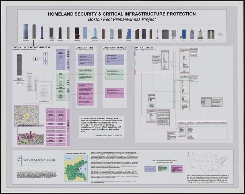
Homeland security & critical infrastructure protection : Boston pilot preparedness project
Description:
Explanation of a pilot project to build detailed geospatial data sets of municipalities in the Boston metropolitan area. Diagram outlines critical facility information to collect, data capture, data maintenance and data storage.
Section no. 1. North Sea to La Fére
Section no 2. La Fére to Verdun
Section no. 3. Verdun to Colmar
Notes:
Includes illustrations of buildings, maps, diagrams and text.
Notes (date):
This date is inferred.
Notes (exhibitions):
Exhibited: "Processing place: how computers and cartographers redrew our world," organized by Norman B. Leventhal Map & Education Center at the Boston Public Library, 2024-2025