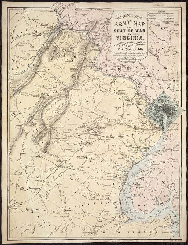
Map of northeast Virginia, Washington, D.C., and part of Maryland showing the location and date of engagements, battles in which cannons were used, country names and boundaries, roads, railroads, towns, drainage, hachures, and a few soundings in the Potomac River. Positions held by Union and Confederate forces are marked by flags.
Description derived from published bibliography.