Skip to search
Skip to main content
Digital Commonwealth
Sign Up / Log In
Search for
Search
Search
Search
Basic
Advanced
Explore
Map
Collections
Institutions
Formats
For Educators
Primary Source Sets
Lesson Plans
Using Primary Sources
Searching Digital Commonwealth
For Institutions
Join Digital Commonwealth
Conferences, Trainings, & Events
How to Contribute Collections
Digitization Services
Board & Committees
Frequently Asked Questions
About
About Digital Commonwealth
News & Announcements
Copyright & Terms of Use
Harmful Content Statement
Partners
API
Contact Us
New Bedford Free Public Library
Map and Chart Collection
Map of Bridgewater, Mass
×
Item Information
Title:
Map of Bridgewater, Mass
Description:
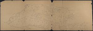
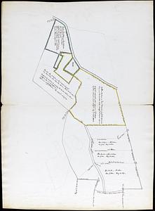
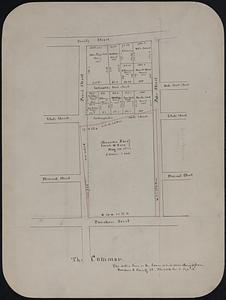
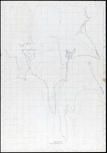
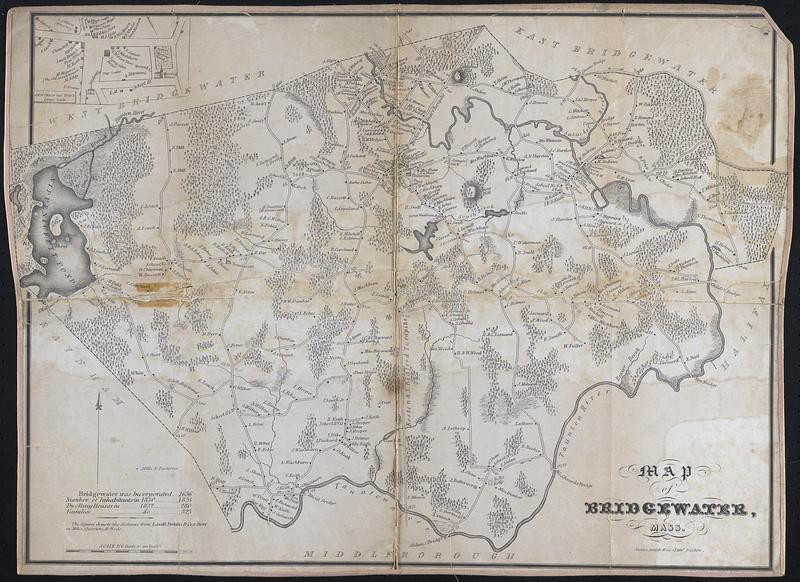
Map of Bridgewater in 1830-1832, includes streets, houses, and names of landowners, some topographic information. Inset: Centre of the town, larger scale
Date:
[1830–1832]
Format:
Maps/Atlases
Genre:
Topographic maps
Location:
New Bedford Free Public Library
Art Room. Cabinet: MC04, Drawer: DR08 (shelf locator)
Collection (local):
Map and Chart Collection
Subjects:
Landowners
Places:
Massachusetts
>
Plymouth (county)
>
Bridgewater
Extent:
1 map ; 18.5 x 25.5 in.
Permalink:
https://ark.digitalcommonwealth.org/ark:/50959/ks65m183j
Terms of Use:
Rights status not evaluated
This work is licensed for use under a Creative Commons Attribution Non-Commercial No Derivatives License (CC BY-NC-ND).
Publisher:
Boston : Annin, Smith & Co., Lithy.
Scale:
1:19,800
Language:
English
Notes:
Title from item or accompanying material.
Notes (date):
Date inferred from item.
This date is inferred.
Accession #:
2021.005.072
show more...
View MODS XML
More Like This
Central Westport Homesteads (Crane Survey)
Chadwich Farms
The Common
Dartmouth Surveys
Find More Like This >>
Tools
Share
Facebook
Pinterest
X
Reddit
Tumblr
Email
Copy link
Add to Folder
Questions/Comments
Cite This Item
Downloads
Primary (full resolution, uncompressed)
(TIF, 73.7 MB)
Large (full resolution)
(JPEG, 6.19 MB)
Medium
(JPEG, 118 KB)