Skip to search
Skip to main content
Digital Commonwealth
Sign Up / Log In
Search for
Search
Search
Search
Basic
Advanced
Explore
Map
Collections
Institutions
Formats
For Educators
Primary Source Sets
Lesson Plans
Using Primary Sources
Searching Digital Commonwealth
For Institutions
Join Digital Commonwealth
Conferences, Trainings, & Events
How to Contribute Collections
Digitization Services
Board & Committees
Frequently Asked Questions
About
About Digital Commonwealth
News & Announcements
Copyright & Terms of Use
Harmful Content Statement
Partners
API
Contact Us
Boston Public Library
Norman B. Leventhal Map & Education Center Collection
/
Boston and New England Maps (Collection of Distinction)
Neighborhoods of Boston
Neighborhoods of Boston
×
Item Information
Title:
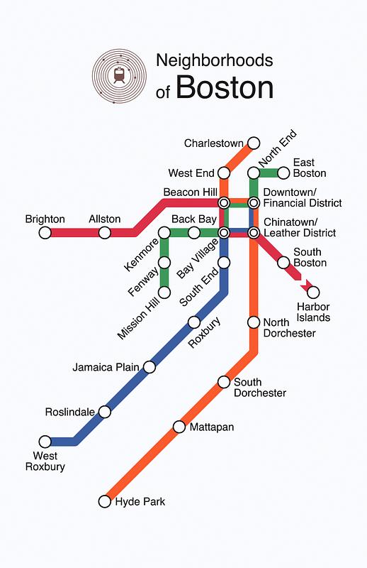
Neighborhoods of Boston
Cartographer:
Raman, Rajiv
Date:
[2013]
Format:
Maps/Atlases
Location:
Boston Public Library
Norman B. Leventhal Map & Education Center
Collection (local):
Norman B. Leventhal Map & Education Center Collection
Subjects:
Boston (Mass.)--Maps
Neighborhoods--Massachusetts--Boston--Maps
Places:
Massachusetts
>
Suffolk (county)
>
Boston
Extent:
1 map : color
Permalink:
https://ark.digitalcommonwealth.org/ark:/50959/ks65mk15q
Terms of Use:
(c) Rajiv Raman
All rights reserved.
Publisher:
[Boston] : [Rajiv Raman]
Language:
English
Notes:
Map of Boston neighborhoods in the style of an MBTA subway map.
Notes (date):
This date is inferred.
Identifier:
Neighborhoods_of_Boston
show more...
View MODS XML
More Like This
Boston development program
Neighborhood and census tract boundaries 1980
Topographic map of Brighton and Allston
Annexation map
Find More Like This >>
Tools
Share
Facebook
Pinterest
X
Reddit
Tumblr
Email
Copy link
Add to Folder
Questions/Comments
Cite This Item
IIIF Manifest