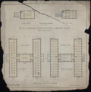
Penikese Island enlarged from U.S. Coast Survey Map
Item Information
- Title:
- Penikese Island enlarged from U.S. Coast Survey Map
- Description:
-
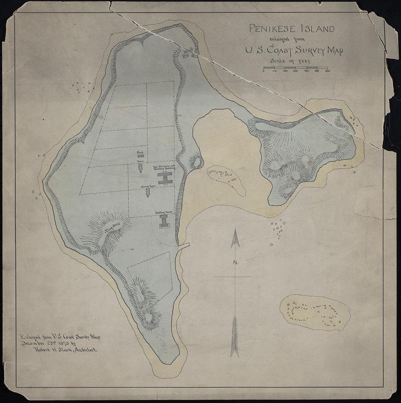
Hand drawn color map of Penikese Island in Gosnold, MA, part of the Elizabeth Islands. Includes topographic info and structures.
- Name on Item:
-
Robert H. Slack, Architect
- Date:
-
December 23, 1873
- Format:
-
Maps/Atlases
Manuscripts
- Genre:
-
Topographic maps
- Location:
-
New Bedford Free Public Library
Art Room. Cabinet: MC04, Drawer: DR07, Container: Map Box 1 (shelf locator) - Collection (local):
-
Map and Chart Collection
- Subjects:
-
Penikese Island School (Mass.)
- Places:
-
MassachusettsDukes (county)Penikese Island (island)
MassachusettsDukes (county)Gosnold Island (island)Elizabeth Islands (area)
MassachusettsDukes (county)Elizabeth Islands (area)
- Extent:
- 1 map : ms., col., ink and watercolor on board ; 14 x 14 in.
- Permalink:
- https://ark.digitalcommonwealth.org/ark:/50959/ms35wx15w
- Terms of Use:
-
Rights status not evaluated
This work is licensed for use under a Creative Commons Attribution Non-Commercial No Derivatives License (CC BY-NC-ND).