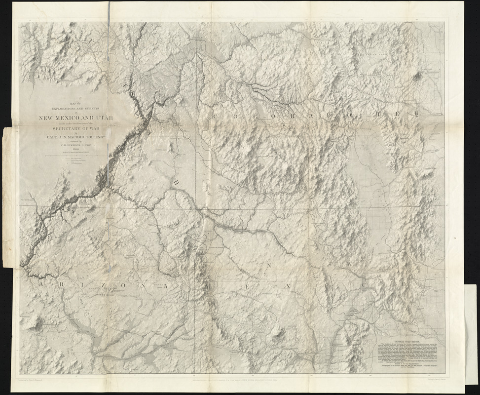
Map of explorations and surveys in New Mexico and Utah made under the direction of the Secretary of War by Capt. J. N. Macomb topl. engrs. assisted by C. H. Dimmock. c. engr. 1860
Map of explorations and surveys in New Mexico and Utah made under the direction of the Secretary of War by Capt. J. N. Macomb topl. engrs. assisted by C. H. Dimmock. c. engr. 1860
Item Information
Title:
Map of explorations and surveys in New Mexico and Utah made under the direction of the Secretary of War by Capt. J. N. Macomb topl. engrs. assisted by C. H. Dimmock. c. engr. 1860
constructed and engraved by Baron F. W. von Egloffstein, topographer to the surveys under the 35th and 38th parellels, Fremont's, Beckwith's and Ives expeditions ; lettering by John L. Hazzard ; ruling by Samuel Sartain
Relief shown by shading and spot heights.
Shows topography, landforms, cities, and exploration trails.
Map accompanies Report of the exploring expedition from Santa Fé, New Mexico, to the junction of the Grand and Green rivers of the great Colorado of the West, in 1859.
Includes descriptive text about the central gold region.