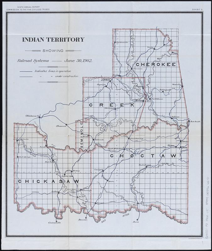
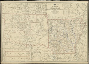
Indian Territory showing railroad systems - June 30, 1902
Indian Territory showing railroad systems - June 30, 1902
Item Information
Title:
Indian Territory showing railroad systems - June 30, 1902
Description:
Map of Indian Territory (later to become the eastern part of the state of Oklahoma) showing the boundaries of the Cherokee, Chickasaw, Choctaw, Creek, and Seminole nations. Shows railroads in operation and under construction. Also shows Public Land Survey System townships.
Detached from a United States House of Representatives document in the United States congressional serial set (Serial Set 4459 H.doc.5/4), following page 164: Annual reports of the Department of the Interior for the fiscal year ended June 30, 1902. Indian affairs, part II. Washington : Government Printing Office, 1903.
In top margin: "Ninth annual report, Commission to the Five Civilized Tribes. Exhibit 5."