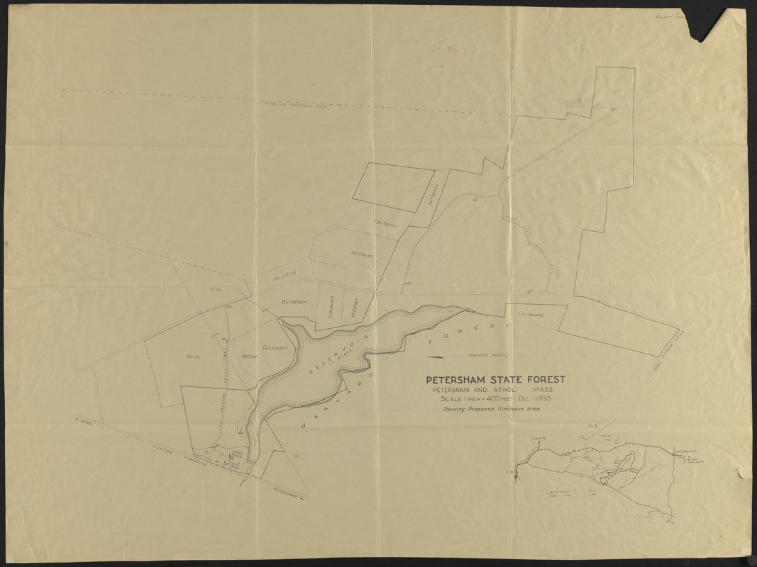
Petersham State Forest
Item Information
- Title:
- Petersham State Forest
- Description:
-
Petersham State Forest. showing Proposed Purchase Area - Includes inset key map of area
- Date:
-
December 1935
- Format:
-
Maps/Atlases
- Location:
-
Harvard University
Harvard Forest Archives
Stack # 2; Drawer # 6 (shelf locator) - Collection (local):
-
The Harvard Forest Map Collection
- Places:
-
MassachusettsWorcester (county)Petersham
- Extent:
- 1 map : black and white ; 27 x 36 in.
- Permalink:
- https://ark.digitalcommonwealth.org/ark:/50959/qv33tb036
- Terms of Use:
-
Public Domain
This work is licensed for use under a Creative Commons Attribution Non-Commercial No Derivatives License (CC BY-NC-ND).