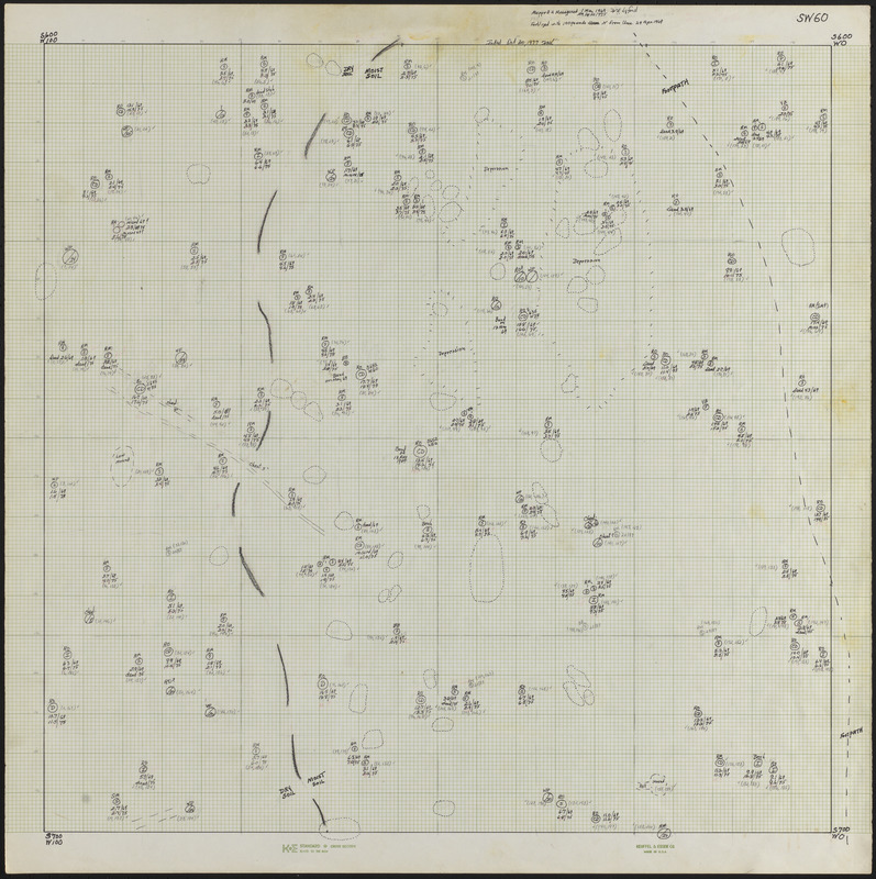
SW60 600 x 0 ft. Block Lyford Grid
Item Information
- Title:
- SW60 600 x 0 ft. Block Lyford Grid
- Description:
-
SW60 600x0 ft. Block Lyford Grid Tree Stem Map - Lyford Grid Experiment - http://harvardforest.fas.harvard.edu/lyford-grid
- Creator:
- Lyford, Walter Henry, 1909-
- Name on Item:
-
Mapped & measured 1 May 1969 W. H. Lyford ; measured 29 April 1975 W. H. Lyford ; inked Oct 30, 1977 WHL
- Date:
-
May 1, 1969–April 29, 1969
- Format:
-
Maps/Atlases
- Genre:
-
Tree stem maps
- Location:
-
Harvard University
Harvard Forest Archives
Stack # 5; Drawer # 9 (shelf locator) - Collection (local):
-
The Harvard Forest Map Collection
- Series:
- Lyford Grid
- Subjects:
-
1969
- Places:
-
MassachusettsWorcester (county)Petersham
Lyford Grid
- Extent:
- 1 map : black and white ; 22 x 22 in.
- Permalink:
- https://ark.digitalcommonwealth.org/ark:/50959/qv33td19h
- Terms of Use:
-
Copyright (c) President and Fellows of Harvard College, Harvard Forest Archives
This work is licensed for use under a Creative Commons Attribution Non-Commercial No Derivatives License (CC BY-NC-ND).