Skip to search
Skip to main content
Digital Commonwealth
Sign Up / Log In
Search for
Search
Search
Search
Basic
Advanced
Explore
Map
Collections
Institutions
Formats
For Educators
Primary Source Sets
Lesson Plans
Using Primary Sources
Searching Digital Commonwealth
For Institutions
Join Digital Commonwealth
Conferences, Trainings, & Events
How to Contribute Collections
Digitization Services
Board & Committees
Frequently Asked Questions
About
About Digital Commonwealth
News & Announcements
Copyright & Terms of Use
Harmful Content Statement
Partners
API
Contact Us
Boston Public Library
Norman B. Leventhal Map & Education Center Collection
/
Maritime Charts and Atlases (Collection of Distinction)
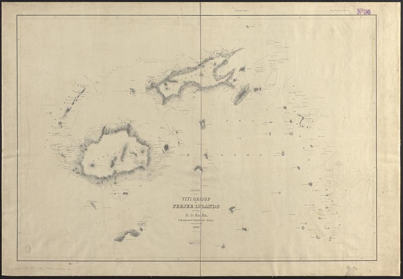
Chart of the Viti Group or Feejee Islands
Chart of the Viti Group or Feejee Islands
×
Item Information
Title:
Chart of the Viti Group or Feejee Islands
Cartographer:
United States Exploring Expedition (1838-1842)
Surveyor:
Wilkes, Charles, 1798-1877
Engraver:
Sherman & Smith
Name on Item:
by the U.S. Ex. Ex., Charles Wilkes Esq, commander 1840 ; eng. by Sherman & Smith
Date:
[1840–1849]
Format:
Maps/Atlases
Genre:
Nautical charts
Location:
Boston Public Library
Norman B. Leventhal Map & Education Center
Collection (local):
Norman B. Leventhal Map & Education Center Collection
Subjects:
Fiji--Maps
Nautical charts--Fiji
Places:
Fiji
Extent:
1 map ; 58 x 85 cm
Permalink:
https://ark.digitalcommonwealth.org/ark:/50959/qv33x775b
Terms of Use:
No known copyright restrictions.
No known restrictions on use.
Scale:
Scale approximately 1:700,000
Language:
English
Notes:
Relief shown by hachures. Depths shown pictorially.
Published in Narrative of the United States Exploring Expedition : during the years 1838, 1839, 1840, 1841, 1842.
Manuscript annotations in pencil.
Notes (date):
This date is inferred.
Identifier:
06_01_017519
Call #:
G9381.P5 1840 .U55
Barcode:
39999085960316
show more...
View MODS XML
More Like This
Anchorages in the Fiji Group : from British surveys ; corrected to ...
The 100th anniversary map of Abraham Lincoln's visit to ...
1630 shoreline
1879. Progress map of the U.S. Geographical Surveys west of the ...
Find More Like This >>
Tools
Share
Facebook
Pinterest
X
Reddit
Tumblr
Email
Copy link
Add to Folder
Questions/Comments
Cite This Item
IIIF Manifest
Downloads
Primary (full resolution, uncompressed)
(TIF, 110 MB)
Large (full resolution)
(JPEG, 9.21 MB)
Medium
(JPEG, 64.9 KB)