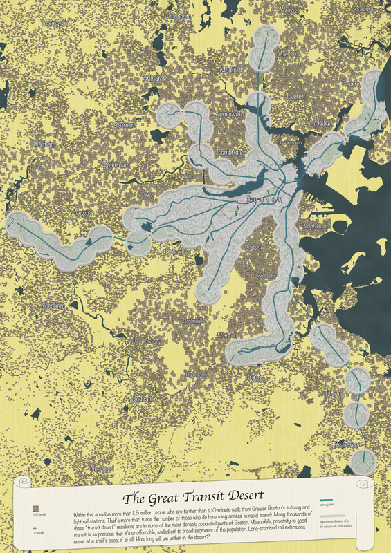
The great transit desert
Item Information
- Title:
- The great transit desert
- Cartographer:
- Woodruff, Andy
- Copyright holder:
- Boston Public Library. Norman B. Leventhal Map and Education Center
- Date:
-
2020
- Format:
-
Maps/Atlases
- Location:
-
Boston Public Library
Norman B. Leventhal Map & Education Center - Collection (local):
-
Norman B. Leventhal Map & Education Center Collection
- Subjects:
-
Local transit--Massachusetts--Boston--Maps
Boston (Mass.)--Maps
Population density--Massachusetts--Boston--Maps
- Places:
-
MassachusettsSuffolk (county)Boston
- Extent:
- 1 map : color
- Permalink:
- https://ark.digitalcommonwealth.org/ark:/50959/rr173g410
- Terms of Use:
-
(c) Norman B. Leventhal Map & Education Center at the Boston Public Library
This work is licensed for use under a Creative Commons Attribution License (CC BY).


