Skip to search
Skip to main content
Digital Commonwealth
Sign Up / Log In
Search for
Search
Search
Search
Basic
Advanced
Explore
Map
Collections
Institutions
Formats
For Educators
Primary Source Sets
Lesson Plans
Using Primary Sources
Searching Digital Commonwealth
For Institutions
Join Digital Commonwealth
Conferences, Trainings, & Events
How to Contribute Collections
Digitization Services
Board & Committees
Frequently Asked Questions
About
About Digital Commonwealth
News & Announcements
Copyright & Terms of Use
Harmful Content Statement
Partners
API
Contact Us
Boston Public Library
Norman B. Leventhal Map & Education Center Collection
/
David Judkins Weaver Papers
/
Boston and New England Maps (Collection of Distinction)
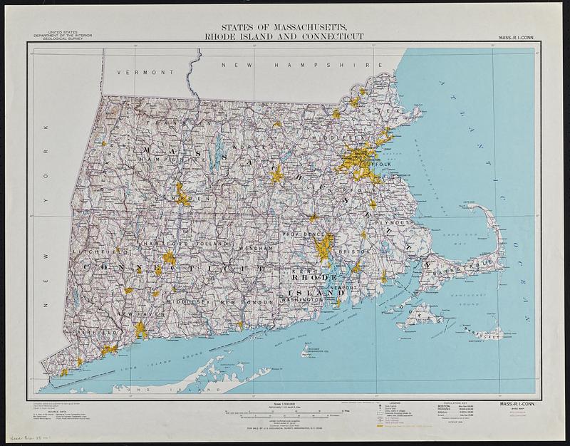
States of Massachusetts, Rhode Island and Connecticut : base map with highways and contours
States of Massachusetts, Rhode Island and Connecticut
×
Item Information
Title:
States of Massachusetts, Rhode Island and Connecticut : base map with highways and contours
Title (alt.):
Mass.-R.I.-Conn., base map with highways and contours
Cartographer:
Geological Survey (U.S.)
Name on Item:
compiled, edited and published by Geological Survey
Date:
1948
Format:
Maps/Atlases
Genre:
Topographic maps
Location:
Boston Public Library
Norman B. Leventhal Map & Education Center
Collection (local):
David Judkins Weaver Papers
Subjects:
Massachusetts--Maps
Rhode Island--Maps
Connecticut--Maps
Places:
Massachusetts
Rhode Island
Connecticut
Extent:
1 map : color ; 48 x 69 cm
Permalink:
https://ark.digitalcommonwealth.org/ark:/50959/sj13fd08b
Terms of Use:
No known copyright restrictions.
No known restrictions on use.
Publisher:
Washington, D.C. : Geological Survey
Edition:
Edition of 1948.
Scale:
Scale 1:500,000. Approximately 1 inch equals 8 miles
Language:
English
Notes:
Relief shown by contours and spot heights.
Identifier:
06_01_018886
Call #:
Weaver folder 38 no.1
show more...
View MODS XML
More Like This
States of Massachusetts, Rhode Island and Connecticut : base map ...
States of Massachusetts, Rhode Island and Connecticut : shaded relief
The city of New York as laid out by the Commissioners with the ...
County Map of the States of New York, New Hampshire, Vermont, ...
Find More Like This >>
Tools
Share
Facebook
Pinterest
X
Reddit
Tumblr
Email
Copy link
Add to Folder
Questions/Comments
Cite This Item
IIIF Manifest
Downloads
Primary (full resolution, uncompressed)
(TIF, 245 MB)
Large (full resolution)
(JPEG, 20.6 MB)
Medium
(JPEG, 126 KB)
We'd love your feedback!
×
Would you be interested in taking a short survey about Digital Commonwealth?