Skip to search
Skip to main content
Digital Commonwealth
Sign Up / Log In
Search for
Search
Search
Search
Basic
Advanced
Explore
Map
Collections
Institutions
Formats
For Educators
Primary Source Sets
Lesson Plans
Using Primary Sources
Searching Digital Commonwealth
For Institutions
Join Digital Commonwealth
Conferences, Trainings, & Events
How to Contribute Collections
Digitization Services
Board & Committees
Frequently Asked Questions
About
About Digital Commonwealth
News & Announcements
Copyright & Terms of Use
Harmful Content Statement
Partners
API
Contact Us
Boston Public Library
Norman B. Leventhal Map & Education Center Collection
/
Maritime Charts and Atlases (Collection of Distinction)
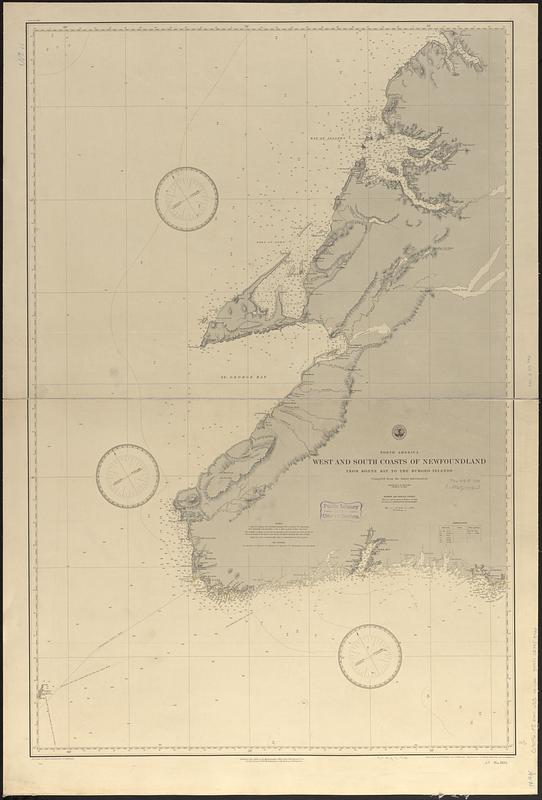
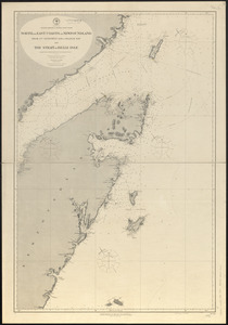
North America, west and south coasts of Newfoundland, from Bonne Bay to the Burgeo Islands : compiled from the latest information
North America, west and south coasts of Newfoundland, from Bonne Bay to the Burgeo Islands
×
Item Information
Title:
North America, west and south coasts of Newfoundland, from Bonne Bay to the Burgeo Islands : compiled from the latest information
Issuing body:
United States. Hydrographic Office
Engraver:
Franke, M. (Max)
Draftsman:
Klakring, A. (Alfred)
Engraver:
Kübel, S. J. (Stephen J.)
Engraver:
Ruebsam, A. C. (Adolph C.)
Draftsman:
Wimpffen, L. F. von (Lebreclit Felix von)
Name on Item:
drawn by L. von Wimpffen and A. Klakring ; engraved by S.J. Kübel, M. Franke and A.C. Ruebsam
Date:
1888
Format:
Maps/Atlases
Genre:
Nautical charts
Location:
Boston Public Library
Norman B. Leventhal Map & Education Center
Collection (local):
Norman B. Leventhal Map & Education Center Collection
Subjects:
Newfoundland and Labrador--Maps
Coasts--Newfoundland and Labrador--Maps
Nautical charts--Newfoundland and Labrador
Places:
Canada
>
Newfoundland and Labrador
(province)
Extent:
1 map ; 98 x 64 cm
Permalink:
https://ark.digitalcommonwealth.org/ark:/50959/t722np10f
Terms of Use:
No known copyright restrictions.
No known restrictions on use.
Publisher:
[Washington, D.C.] : Hydrographic Office
Scale:
Scale approximately 1:300,000
Language:
English
Notes:
Relief shown by hachures and spot heights. Depths shown by soundings and isolines.
Identifier:
06_01_017035
Call #:
G9096.P5 svar .U55 no. 1104
Barcode:
39999085953923
show more...
View MODS XML
More Like This
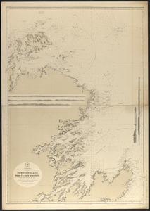
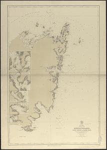
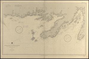
North America, east coast of Newfoundland, Fogo Id. to Cape ...
North America, north east coast of Newfoundland, Cape Onion to ...
North America, south coast of Newfoundland from the Burgeo Islands ...
North America--north east coast, north and east coasts of ...
Find More Like This >>
Tools
Share
Facebook
Pinterest
X
Reddit
Tumblr
Email
Copy link
Add to Folder
Questions/Comments
Cite This Item
IIIF Manifest
Downloads
Primary (full resolution, uncompressed)
(TIF, 146 MB)
Large (full resolution)
(JPEG, 12.3 MB)
Medium
(JPEG, 67.7 KB)