Skip to search
Skip to main content
Digital Commonwealth
Sign Up / Log In
Search for
Search
Search
Search
Basic
Advanced
Explore
Map
Collections
Institutions
Formats
For Educators
Primary Source Sets
Lesson Plans
Using Primary Sources
Searching Digital Commonwealth
For Institutions
Join Digital Commonwealth
Conferences, Trainings, & Events
How to Contribute Collections
Digitization Services
Board & Committees
Frequently Asked Questions
About
About Digital Commonwealth
News & Announcements
Copyright & Terms of Use
Harmful Content Statement
Partners
API
Contact Us
Boston Public Library
Norman B. Leventhal Map & Education Center Collection
/
Urban Maps (Collection of Distinction)
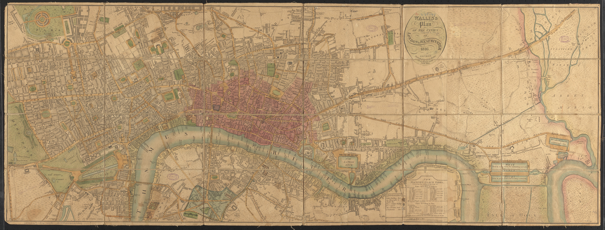
Wallis's plan of the cities of London & Westminster
Walliss plan of the cities of London & Westminster
×
Item Information
Title:
Wallis's plan of the cities of London & Westminster
Title (alt.):
Plan of the cities of London & Westminster
Creator:
Wallis, J. (John), -1818
Date:
1816
Format:
Maps/Atlases
Location:
Boston Public Library
Norman B. Leventhal Map & Education Center
Collection (local):
Norman B. Leventhal Map & Education Center Collection
Subjects:
London (England)--Maps
Westminster (London, England)--Maps
Places:
England
>
London
>
City of Westminster
Extent:
1 map : col., dissected and mounted on linen ; 42 x 116 cm.
Permalink:
https://ark.digitalcommonwealth.org/ark:/50959/ww72bp31j
Terms of Use:
No known copyright restrictions.
No known restrictions on use.
Publisher:
London : John Wallis
Scale:
Scale [ca. 1:9,748]
Language:
English
Notes:
Map of London from Hyde Park in the west to East India Docks in the east, showing public buildings and City of London boundary.
Includes legend and explanation of new hackney coach fares commencing June 23rd, 1808.
Identifier:
06_01_006971
Call #:
G5754.L7 1816 .W35
Barcode:
39999059028934
show more...
View MODS XML
More Like This
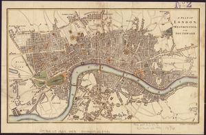
A plan of London, Westminster, and Southwark
The Builder map of the county of London : shewing the boundaries ...
The Builder map of the county of London : shewing the boundaries ...
Civitas Londinum ano. dmi. circiter MDLX
Find More Like This >>
Tools
Share
Facebook
Pinterest
X
Reddit
Tumblr
Email
Copy link
Add to Folder
Questions/Comments
Cite This Item
IIIF Manifest
Downloads
Primary (full resolution, uncompressed)
(TIF, 89 MB)
Large (full resolution)
(JPEG, 7.47 MB)
Medium
(JPEG, 868 KB)
We'd love your feedback!
×
Would you be interested in taking a short survey about Digital Commonwealth?