Boston Public LibraryNorman B. Leventhal Map & Education Center Collection / Urban Maps (Collection of Distinction) / Boston and New England Maps (Collection of Distinction)
Plan of the cemetery of Mount Auburn
Item Information
- Title:
- Plan of the cemetery of Mount Auburn
- Description:
-
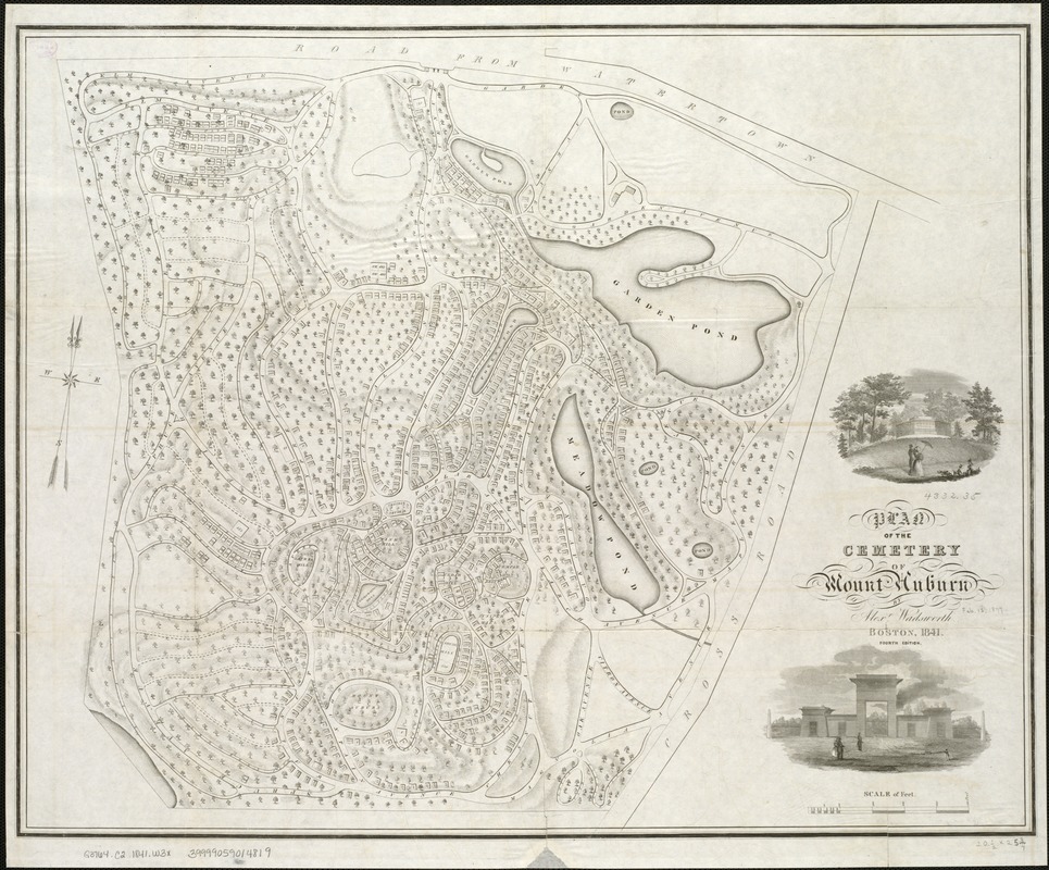
Mount Auburn Cemetery was consecrated in 1831 and is situated in Watertown and Cambridge, Massachusetts. Designed by Henry Dearborn with assistance from Alexander Wadsworth, Mount Auburn is celebrated as the first landscaped rural cemetery in the United States. Winding paths hug the cemetery’s natural hills and valleys, while dramatic plantings of shrubs and weeping trees—particularly the willow—were intended to encourage pensive strolls among dramatic arches, urns, “ruins,” decorative ponds, tombs, and burial plots. Later in the century, park advocates would point to these bucolic cemeteries to highlight the inadequacies of small urban parks, prompting the development of large, public open spaces within city limits.
- Creator:
- Wadsworth, Alexander, 1806-1898
- Name on Item:
-
by Alex. Wadsworth.
- Date:
-
1841
- Format:
-
Maps/Atlases
- Location:
-
Boston Public Library
Norman B. Leventhal Map & Education Center - Collection (local):
-
Norman B. Leventhal Map & Education Center Collection
- Subjects:
-
Mount Auburn Cemetery (Watertown and Cambridge, Mass.)--Maps
Cemeteries--Massachusetts--Cambridge--Maps
Cemeteries--Massachusetts--Watertown--Maps
Watertown (Mass.)--Maps
Cambridge (Mass.)--Maps
- Places:
-
Massachusetts > Middlesex (county) > Cambridge
Massachusetts > Middlesex (county) > Watertown
Mount Auburn Cemetery
- Extent:
- 1 map ; 52 x 65 cm.
- Permalink:
- https://ark.digitalcommonwealth.org/ark:/50959/x059cc34p
- Terms of Use:
-
No known copyright restrictions.
No known restrictions on use.
- Publisher:
-
Boston :
[s.n.]
- Edition:
- 4th ed.
- Scale:
-
Scale [ca. 1:1,450].
- Language:
-
English
- Notes:
-
Relief shown by hachures.
Shows paths and plots.
Includes two inset views.
- Notes (exhibitions):
-
Exhibited: "Breathing Room: Mapping Boston's Green Spaces" organized by the Norman B. Leventhal Map Center at the Boston Public Library, 2018.
- Identifier:
-
06_01_005498
- Call #:
-
G3764.C2 1841 .W3x
- Barcode:
-
39999059014819
Downloads
- Primary (full resolution, uncompressed)(TIF, 120 MB)
- Large (full resolution)(JPEG, 10 MB)
- Medium(JPEG, 299 KB)