Skip to search
Skip to main content
Digital Commonwealth
Sign Up / Log In
Search for
Search
Search
Search
Basic
Advanced
Explore
Map
Collections
Institutions
Formats
For Educators
Primary Source Sets
Lesson Plans
Using Primary Sources
Searching Digital Commonwealth
For Institutions
Join Digital Commonwealth
Conferences, Trainings, & Events
How to Contribute Collections
Digitization Services
Board & Committees
Frequently Asked Questions
About
About Digital Commonwealth
News & Announcements
Copyright & Terms of Use
Harmful Content Statement
Partners
API
Contact Us
Boston Public Library
Boston and New England Maps (Collection of Distinction)
/
U.S. Government Documents Maps Collection
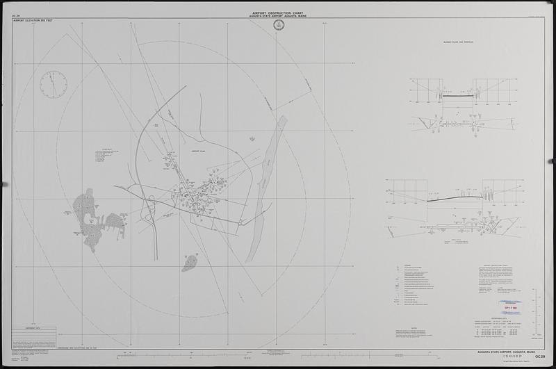
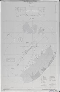
Airport obstruction chart OC 29, Augusta State Airport, Augusta, Maine
Airport obstruction chart OC 29, Augusta State Airport, Augusta, Maine
×
Item Information
Title:
Airport obstruction chart OC 29, Augusta State Airport, Augusta, Maine
Issuing body:
United States. National Ocean Service
Name on Item:
surveyed and compiled by the National Ocean Service (NOS)
Date:
1993
Format:
Maps/Atlases
Location:
Boston Public Library
Central Library in Copley Square
Collection (local):
U.S. Government Documents Maps Collection
Subjects:
Airports--Maine--Augusta--Maps
Runways (Aeronautics)--Maine--Augusta--Maps
Aeronautical charts--Maine--Augusta
Places:
Maine
>
Kennebec (county)
>
Augusta
Extent:
1 map ; 76 x 121 cm.
Permalink:
https://ark.digitalcommonwealth.org/ark:/50959/xs55sc98b
Terms of Use:
No known copyright restrictions.
No known restrictions on use.
Publisher:
Washington, D.C. : The Service
Scale:
Scale 1:12,000
Language:
English
Notes:
Airport elevation 352 feet.
Shipping list no.: 93-0183-P.
Includes runway plans and profiles, and operational data.
Identifier:
06_01_019182
Call #:
GOV DOCS MAP C 55.411/3:OC 29
Barcode:
37777009698960
show more...
View MODS XML
More Like This
Airport obstruction chart
Airport obstruction chart OC 10, Albany County Airport, Albany, ...
Airport obstruction chart OC 110, Daytona Beach Regional Airport, ...
Airport obstruction chart OC 112, Cortez-Montezuma County Airport, ...
Find More Like This >>
Tools
Share
Facebook
Pinterest
X
Reddit
Tumblr
Email
Copy link
Add to Folder
Questions/Comments
Cite This Item
IIIF Manifest
Downloads
Primary (full resolution, uncompressed)
(TIF, 554 MB)
Large (full resolution)
(JPEG, 46.5 MB)
Medium
(JPEG, 56.6 KB)