61. Philips' map of the seat of war shewing the country from Paris to Berlin, with the Rhine Provinces on a large scale Creator: George Philip & Son Format: Maps/Atlases Collection: Norman B. Leventhal Map & Education Center Collection Date: [1870] Institution: Boston Public Library
62. Philips' new commercial map of Europe Creator: George Philip & Son Format: Maps/Atlases Collection: Norman B. Leventhal Map & Education Center Collection Date: 1920 Institution: Boston Public Library
63. Philips' new map of Central Europe Creator: George Philip & Son Format: Maps/Atlases Collection: Norman B. Leventhal Map & Education Center Collection Date: [ca. 1870–1879] Institution: Boston Public Library
64. Photo relief map of Europe Creator: Brion, Henry F., Brion, Henry F., McClure, Edmund, -1922, and Society for Promoting Christian Knowledge (Great Britain) Format: Maps/Atlases Collection: Norman B. Leventhal Map & Education Center Collection Date: 1885 Institution: Boston Public Library
65. Physiographic diagram of Europe Creator: Lobeck, A. K. (Armin Kohl), 1886-1958 Format: Maps/Atlases Collection: Norman B. Leventhal Map & Education Center Collection Date: 1923 Institution: Boston Public Library
66. Political map of Europe Creator: C.S. Hammond & Company Format: Maps/Atlases Collection: Norman B. Leventhal Map & Education Center Collection Date: [ca. 1920–1922] Institution: Boston Public Library
67. The races of Europe Creator: A.J. Nystrom and Company Format: Maps/Atlases Collection: Norman B. Leventhal Map & Education Center Collection Date: 1919 Institution: Boston Public Library
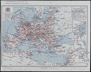
68. Reseau parcouru par les voitures de la Compagnie Internationale des Wagons-lits Creator: Hermann, L.; Dufrénoy (Firm) Format: Maps/Atlases Collection: Norman B. Leventhal Map & Education Center Collection Date: [1925] Institution: Boston Public Library
69. Saishin ōshū daichizu Creator: Ōsaka Mainichi Shinbunsha Format: Maps/Atlases Collection: Norman B. Leventhal Map & Education Center Collection Date: 1942 Institution: Boston Public Library
70. Serio-comic war map for the year 1877 Creator: Rose, Fred. W. (Frederick W.) Format: Maps/Atlases Collection: Norman B. Leventhal Map & Education Center Collection Date: [1877] Institution: Boston Public Library
71. Shepherd's map of the seat of war Creator: Shepherd, G. H. Format: Maps/Atlases Collection: Norman B. Leventhal Map & Education Center Collection Date: [1870–1871] Institution: Boston Public Library
72. Stanford's enlarged map of the seat of war Creator: Stanford, Edward, 1827-1904 Format: Maps/Atlases Collection: Norman B. Leventhal Map & Education Center Collection Date: 1870 Institution: Boston Public Library
73. Stanford's shilling map of the seat of war Creator: Stanford, Edward, 1827-1904 Format: Maps/Atlases Collection: Norman B. Leventhal Map & Education Center Collection Date: 1870 Institution: Boston Public Library
74. Strategic map of Central Europe showing the international frontiers Creator: United States. War Department. General Staff. War College Division, Williams, Arch. B., and Bontz, Geo. F. Format: Maps/Atlases Collection: Norman B. Leventhal Map & Education Center Collection Date: 1915 Institution: Boston Public Library
75. The travellers; or, a tour through Europe Creator: Spooner, William, active 1831-1854 Format: Maps/Atlases Collection: Norman B. Leventhal Map & Education Center Collection Date: 1842 Institution: Boston Public Library
76. Verkehrs-karte von Europa : übersichts grösserer eisenbahnverbindungen, telegraphen und überseeischer dampfschiffahrt Creator: Berghaus, Hermann, 1828-1890, Risch, M., and Justus Perthes (Firm : Gotha, Germany) Format: Maps/Atlases Collection: Norman B. Leventhal Map & Education Center Collection Date: 1885 Institution: Boston Public Library
77. The victory war map Creator: Chase, Ernest Dudley, 1878-1966 Format: Maps/Atlases Collection: Norman B. Leventhal Map & Education Center Collection Date: 1942 Institution: Boston Public Library
78. A vision of Private Kutschkes of the German National Guard = Traumgebild des deutschen Landwehrmanns Kutschke! Creator: Government Loan Organization. Second Federal Reserve District. Liberty Loan Committee Format: Maps/Atlases Collection: Norman B. Leventhal Map & Education Center Collection Date: [ca. 1917–1918] Institution: Boston Public Library
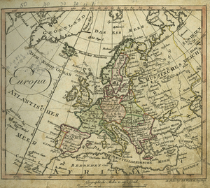
79. Europa Creator: Walch, Johannes Format: Maps/Atlases Collection: Historic Maps Date: 1810 Institution: Salem State University Archives and Special Collections
80. Generale Ptholemei Creator: Schott, Johann, 1477-1548; Waldseemüller, Martin, 1470-1519 Format: Maps/Atlases Collection: Sidney R. Knafel Map Collection at Phillips Academy Date: [1513] Institution: Phillips Academy