11301. West Indies, Haiti or Santo Domingo, Cayes, Flamand, St. Louis and Meste Bays : from French government surveys to 1872, with additions from other surveys to 1876 Creator: United States. Hydrographic Office; Leggo Bros. & Co. Format: Maps/Atlases Collection: Maritime Charts and Atlases (Collection of Distinction) / Norman B. Leventhal Map & Education Center Collection Date: 1889 Institution: Boston Public Library
11302. West Indies, Haïti or St. Domingo, Gonaïves Bay : from a French survey, 1847 Creator: United States. Hydrographic Office Format: Maps/Atlases Collection: Maritime Charts and Atlases (Collection of Distinction) / Norman B. Leventhal Map & Education Center Collection Date: 1882 Institution: Boston Public Library
11303. West Indies, harbors of Jamaica : from British surveys to 1879, cor. to 1881 Creator: United States. Hydrographic Office Format: Maps/Atlases Collection: Maritime Charts and Atlases (Collection of Distinction) / Norman B. Leventhal Map & Education Center Collection Date: 1888 Institution: Boston Public Library
11304. West Indies, harbors of Jamaica : from British surveys to 1879, corrected to 1881 Creator: United States. Hydrographic Office Format: Maps/Atlases Collection: Maritime Charts and Atlases (Collection of Distinction) / Norman B. Leventhal Map & Education Center Collection Date: 1881 Institution: Boston Public Library
11305. West Indies, harbors on Dominica Island : republished from the Brt. Admty. chart of June 1873 Creator: United States. Hydrographic Office Format: Maps/Atlases Collection: Maritime Charts and Atlases (Collection of Distinction) / Norman B. Leventhal Map & Education Center Collection Date: 1873 Institution: Boston Public Library
11306. West Indies, Honduras, Chinchorro Bank : from a British survey in 1839 Creator: United States. Hydrographic Office, Erni, A. (Adolphe), Klakring, A. (Alfred), and Ourdan, V. L. (Vincent L.) Format: Maps/Atlases Collection: Maritime Charts and Atlases (Collection of Distinction) / Norman B. Leventhal Map & Education Center Collection Date: 1888 Institution: Boston Public Library
11307. West Indies, Honduras Gulf with the Zapotillos Cays Creator: United States. Hydrographic Office, Owen, Richard (Navy Commander), and Barnett, E. (Edward), 1799-1879 Format: Maps/Atlases Collection: Maritime Charts and Atlases (Collection of Distinction) / Norman B. Leventhal Map & Education Center Collection Date: 1873 Institution: Boston Public Library
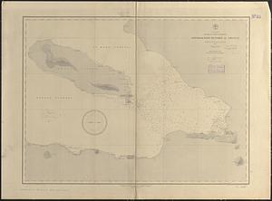
11308. West Indies, Island of Antigua : from British surveys in 1848 and 1863 Creator: United States. Hydrographic Office, Enthoffer, E. J. (Edward J.), Hazzard, J. L. (John L.), and Pohlers, G. F. (George F.) Format: Maps/Atlases Collection: Maritime Charts and Atlases (Collection of Distinction) / Norman B. Leventhal Map & Education Center Collection Date: 1889 Institution: Boston Public Library
11309. West Indies, island of Guadeloupe, Basse-Terre Roads : from a French survey in 1867 Creator: United States. Hydrographic Office, Enthoffer, E. J. (Edward J.), Latimer, J. S. (Joseph S.), and Ruebsam, E. A. (E. August) Format: Maps/Atlases Collection: Maritime Charts and Atlases (Collection of Distinction) / Norman B. Leventhal Map & Education Center Collection Date: 1889 Institution: Boston Public Library
11310. West Indies, island of Guadeloupe, Port du Moule : from a French survey in 1868 Creator: United States. Hydrographic Office, Erni, A. (Adolphe), Peabody, W. F. (William F.), and Pohlers, G. F. (George F.) Format: Maps/Atlases Collection: Maritime Charts and Atlases (Collection of Distinction) / Norman B. Leventhal Map & Education Center Collection Date: 1889 Institution: Boston Public Library
11311. West Indies, Island of Guadeloupe, Port Louis : from a French survey in 1868 Creator: United States. Hydrographic Office, Erni, A. (Adolphe), Gaskins, R. H. (Richard H.), and Noetzel, G. (Gregor) Format: Maps/Atlases Collection: Maritime Charts and Atlases (Collection of Distinction) / Norman B. Leventhal Map & Education Center Collection Date: 1888 Institution: Boston Public Library
11312. West Indies, island of Guadeloupe, Port Sainte Marie : from a French survey in 1869 Creator: United States. Hydrographic Office, Erni, A. (Adolphe), Gaskins, R. H. (Richard H.), and Noetzel, G. (Gregor) Format: Maps/Atlases Collection: Maritime Charts and Atlases (Collection of Distinction) / Norman B. Leventhal Map & Education Center Collection Date: 1888 Institution: Boston Public Library
11313. West Indies, island of Guadeloupe, Sainte Anne anchorage : from a French survey in 1867 Creator: United States. Hydrographic Office, Erni, A. (Adolphe), Noetzel, G. (Gregor), and Peabody, W. F. (William F.) Format: Maps/Atlases Collection: Maritime Charts and Atlases (Collection of Distinction) / Norman B. Leventhal Map & Education Center Collection Date: 1888 Institution: Boston Public Library
11314. West Indies, Island of Guadeloupe, St. François anchorage : from a French survey in 1867 Creator: United States. Hydrographic Office, Franke, M. (Max), Noetzel, G. (Gregor), and Peabody, W. F. (William F.) Format: Maps/Atlases Collection: Maritime Charts and Atlases (Collection of Distinction) / Norman B. Leventhal Map & Education Center Collection Date: 1888 Institution: Boston Public Library
11315. West Indies, island of Haïti, Cape Haïti Harbor (Cape Guarico of the Spaniards) : from a British survey in 1840 : republication of Brit. Admty. chart no. 1714,... Creator: United States. Hydrographic Office Format: Maps/Atlases Collection: Maritime Charts and Atlases (Collection of Distinction) / Norman B. Leventhal Map & Education Center Collection Date: 1877 Institution: Boston Public Library
11316. West Indies, island of Santo Domingo, approaches to Port au Prince : compiled from the latest information 1887 Creator: United States. Hydrographic Office, Ourdan, V. L. (Vincent L.), Roberts, A. C. (Arthur Carr), and Sefton, W. P. (William P.) Format: Maps/Atlases Collection: Maritime Charts and Atlases (Collection of Distinction) / Norman B. Leventhal Map & Education Center Collection Date: [1889] Institution: Boston Public Library
11317. West Indies, island of Santo Domingo, Caldera Bay : from a survey in 1870 by the officers of the U.S.S. Nantasket, Lt. Comdr. R.S. McCook U.S.N., comdg., with... Creator: United States. Hydrographic Office, Erni, A. (Adolphe), Klakring, A. (Alfred), and Ourdan, V. L. (Vincent L.) Format: Maps/Atlases Collection: Maritime Charts and Atlases (Collection of Distinction) / Norman B. Leventhal Map & Education Center Collection Date: 1889 Institution: Boston Public Library
11318. West Indies, island of Santo Domingo, harbor of Jacmel : from an English survey in 1817 Creator: United States. Hydrographic Office, Enthoffer, J. (Joseph), 1818-1901, Owen, F. D., and Waddey, J. A. (John A.) Format: Maps/Atlases Collection: Maritime Charts and Atlases (Collection of Distinction) / Norman B. Leventhal Map & Education Center Collection Date: 1885 Institution: Boston Public Library
11319. West Indies, Island of Santo Domingo, Santo Domingo Harbor : surveyed by the officers of H.M.S. Hound, 1849 Creator: United States. Hydrographic Office, Wansleben, W. A. (William A.), Enthoffer, J. (Joseph), 1818-1901, and Klakring, C. T. (Charles T.) Format: Maps/Atlases Collection: Maritime Charts and Atlases (Collection of Distinction) / Norman B. Leventhal Map & Education Center Collection Date: 1889 Institution: Boston Public Library
11320. West Indies, island of Santo Domingo, the Môle of St. Nicolas : from the latest English survey Creator: United States. Hydrographic Office, Enthoffer, J. (Joseph), 1818-1901, and Owen, F. D. Format: Maps/Atlases Collection: Maritime Charts and Atlases (Collection of Distinction) / Norman B. Leventhal Map & Education Center Collection Date: 1885 Institution: Boston Public Library