11081. To the Right Honourable John Lord Sommers, Baron of Evesham in ye county of Worcester, president of Her Majesty's most honourable Privy Council &c., this map of North... Creator: Moll, Herman, d. 1732 Format: Maps/Atlases Collection: Norman B. Leventhal Map & Education Center Collection Date: [1710–1719] Institution: Boston Public Library
11082. To the Right Honourable the Master, Wardens, & Elder Bretham of the Trinity House, this chart of the entrances to The River Thames is ... dedicated Creator: Heather, William, 1764-1812 Format: Maps/Atlases Collection: Norman B. Leventhal Map & Education Center Collection Date: 1801 Institution: Boston Public Library
11083. To the Right Honourable William, Lord Cowper, Lord High Chancellor of Great Britain, this map of Asia : according to ye newest and most exact observations is most... Creator: Moll, Herman, d. 1732 Format: Maps/Atlases Collection: Norman B. Leventhal Map & Education Center Collection Date: [1710–1719] Institution: Boston Public Library
11084. Tobago Creator: Jefferys, Thomas, -1771, Sayer, Robert, 1725-1794, and Ross, David Format: Maps/Atlases Collection: American Revolutionary War-Era Maps (Collection of Distinction) / Norman B. Leventhal Map & Education Center Collection Date: [1768] Institution: Boston Public Library
11085. Tobago from actual surveys and observations Creator: Jefferys, Thomas, d. 1771 Format: Maps/Atlases Collection: American Revolutionary War-Era Maps (Collection of Distinction) / Norman B. Leventhal Map & Education Center Collection Date: 1775 Institution: Boston Public Library
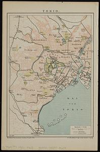
11086. Tokio Creator: F.A. Brockhaus (Firm) Format: Maps/Atlases Collection: Norman B. Leventhal Map & Education Center Collection Date: [1900] Institution: Boston Public Library
11087. Tomlinsons map of Petersburg : showing the scene of Genl. Grants operations Creator: Stoecklein, Charles. Format: Maps/Atlases Collection: Norman B. Leventhal Map & Education Center Collection Date: 1864 Institution: Boston Public Library
11088. Tonto National Forest, Arizona Creator: United States. Forest Service. Southwestern Region, Davis, L. C., Landon, F. E., Johnson, C. G., and Geological Survey (U.S.) Format: Maps/Atlases Collection: Norman B. Leventhal Map & Education Center Collection Date: 1927 Institution: Boston Public Library
11089. Topographia aug. Turon. ducatus et confinium Galliae celticae sinu complectitur cuius latitudo ab aequinoctiali versus arcticum... extenditur Creator: François, Isaac, 1566-1650 Format: Maps/Atlases Collection: Norman B. Leventhal Map & Education Center Collection Date: 1592 Institution: Boston Public Library
11090. Topographic & detail sheets of Rainy Lake & upper boundary waters Creator: International Joint Commission Format: Maps/Atlases Collection: Norman B. Leventhal Map & Education Center Collection Date: 1928 Institution: Boston Public Library
11091. Topographic map of Brighton and Allston Creator: Boston Redevelopment Authority Format: Maps/Atlases Collection: Boston Redevelopment Authority Collection / Boston and New England Maps (Collection of Distinction) / Norman B. Leventhal Map & Education Center Collection / Urban Maps (Collection of Distinction) Date: [ca. 1990–1999] Institution: Boston Public Library
11092. Topographic map of Clinton County, Illinois Creator: Illinois State Geological Survey Format: Maps/Atlases Collection: Norman B. Leventhal Map & Education Center Collection Date: 1914 Institution: Boston Public Library
11093. Topographic map of Gallatin County, Illinois Creator: Illinois State Geological Survey Format: Maps/Atlases Collection: Norman B. Leventhal Map & Education Center Collection Date: 1916 Institution: Boston Public Library
11094. Topographic map of Hardin County, Illinois Creator: Illinois State Geological Survey Format: Maps/Atlases Collection: Norman B. Leventhal Map & Education Center Collection Date: 1917 Institution: Boston Public Library
11095. Topographic map of Lawrence County, Illinois Creator: Illinois State Geological Survey Format: Maps/Atlases Collection: Norman B. Leventhal Map & Education Center Collection Date: 1917 Institution: Boston Public Library
11096. The topographic map of Manchoukuo Creator: M. Kobayashi & Co Format: Maps/Atlases Collection: Norman B. Leventhal Map & Education Center Collection Date: [1933] Institution: Boston Public Library
11097. Topographic map of Massachusetts and Rhode Island Creator: Geological Survey (U.S.) Format: Maps/Atlases Collection: Norman B. Leventhal Map & Education Center Collection Date: 1915 Institution: Boston Public Library
11098. Topographic map of McDonough County, Illinois Creator: Illinois State Geological Survey Format: Maps/Atlases Collection: Norman B. Leventhal Map & Education Center Collection Date: 1919 Institution: Boston Public Library
11099. Topographic map of Monroe County, Illinois Creator: Illinois State Geological Survey Format: Maps/Atlases Collection: Norman B. Leventhal Map & Education Center Collection Date: 1914 Institution: Boston Public Library
11100. Topographic map of Randolph County, Illinois Creator: Illinois State Geological Survey Format: Maps/Atlases Collection: Norman B. Leventhal Map & Education Center Collection Date: 1919 Institution: Boston Public Library