141. Charlestown urban renewal area r-42 : GNRP map no. 2 Creator: Boston Redevelopment Authority Format: Maps/Atlases Collection: Boston Redevelopment Authority Collection / Boston and New England Maps (Collection of Distinction) / Urban Maps (Collection of Distinction) Date: April 2, 1964 Institution: Boston Public Library
142. Charlestown urban renewal area r-42 : GNRP map no. 1 Creator: Boston Redevelopment Authority Format: Maps/Atlases Collection: Boston Redevelopment Authority Collection / Boston and New England Maps (Collection of Distinction) / Urban Maps (Collection of Distinction) Date: April 2, 1964 Institution: Boston Public Library
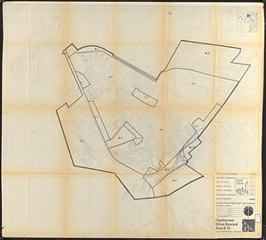
143. Charlestown urban renewal area r-55 : property map and perimeter boundaries Creator: Boston Redevelopment Authority Format: Maps/Atlases Collection: Boston Redevelopment Authority Collection / Boston and New England Maps (Collection of Distinction) / Urban Maps (Collection of Distinction) Date: January 29, 1964 Institution: Boston Public Library
144. Charlestown urban renewal area r-55 : proposed land use Creator: Boston Redevelopment Authority Format: Maps/Atlases Collection: Boston Redevelopment Authority Collection / Boston and New England Maps (Collection of Distinction) / Urban Maps (Collection of Distinction) Date: January 29, 1964 Institution: Boston Public Library
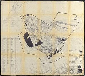
145. Charlestown urban renewal area r-55 : existing land use Creator: Boston Redevelopment Authority Format: Maps/Atlases Collection: Boston Redevelopment Authority Collection / Boston and New England Maps (Collection of Distinction) / Urban Maps (Collection of Distinction) Date: [1963] Institution: Boston Public Library
146. Charlestown urban renewal area r-55 : disposition parcels Creator: Boston Redevelopment Authority Format: Maps/Atlases Collection: Boston Redevelopment Authority Collection / Boston and New England Maps (Collection of Distinction) / Urban Maps (Collection of Distinction) Date: January 29, 1964 Institution: Boston Public Library
147. Charlestown urban renewal area r-55 : right of way adjustments Creator: Boston Redevelopment Authority Format: Maps/Atlases Collection: Boston Redevelopment Authority Collection / Boston and New England Maps (Collection of Distinction) / Urban Maps (Collection of Distinction) Date: January 29, 1964 Institution: Boston Public Library
148. Charlestown urban renewal area r-55 : building deficiencies Creator: Boston Redevelopment Authority Format: Maps/Atlases Collection: Boston Redevelopment Authority Collection / Boston and New England Maps (Collection of Distinction) / Urban Maps (Collection of Distinction) Date: [1963] Institution: Boston Public Library
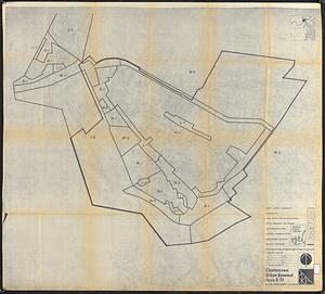
149. Charlestown urban renewal area r-55 : treatment areas Creator: Boston Redevelopment Authority Format: Maps/Atlases Collection: Boston Redevelopment Authority Collection / Boston and New England Maps (Collection of Distinction) / Urban Maps (Collection of Distinction) Date: January 29, 1964 Institution: Boston Public Library
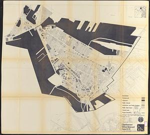
150. Charlestown urban renewal area r-55 : existing land use Creator: Boston Redevelopment Authority Format: Maps/Atlases Collection: Boston Redevelopment Authority Collection / Boston and New England Maps (Collection of Distinction) / Urban Maps (Collection of Distinction) Date: January 29, 1964 Institution: Boston Public Library
151. Charlestown urban renewal area r-55 : existing zoning Creator: Boston Redevelopment Authority Format: Maps/Atlases Collection: Boston Redevelopment Authority Collection / Boston and New England Maps (Collection of Distinction) / Urban Maps (Collection of Distinction) Date: January 29, 1964 Institution: Boston Public Library
152. Charlestown urban renewal area r-55 : proposed zoning Creator: Boston Redevelopment Authority Format: Maps/Atlases Collection: Boston Redevelopment Authority Collection / Boston and New England Maps (Collection of Distinction) / Urban Maps (Collection of Distinction) Date: January 29, 1964 Institution: Boston Public Library
153. Charlestown urban renewal area r-55 : building deficiencies Creator: Boston Redevelopment Authority Format: Maps/Atlases Collection: Boston Redevelopment Authority Collection / Boston and New England Maps (Collection of Distinction) / Urban Maps (Collection of Distinction) Date: January 29, 1964 Institution: Boston Public Library
154. City of Boston topographic and planimetric survey Creator: Boston Redevelopment Authority, New England Survey Service, inc., and Fairchild Aerial Surveys, inc. Format: Maps/Atlases Collection: Boston Redevelopment Authority Collection / Boston and New England Maps (Collection of Distinction) / Urban Maps (Collection of Distinction) Date: 1962 Institution: Boston Public Library
155. Columbia Point feasibility survey area Creator: Boston Redevelopment Authority Format: Maps/Atlases Collection: Boston Redevelopment Authority Collection / Boston and New England Maps (Collection of Distinction) / Urban Maps (Collection of Distinction) Date: [ca. 1963] Institution: Boston Public Library
156. Conceptual plan Creator: Boston Redevelopment Authority Format: Maps/Atlases Collection: Boston Redevelopment Authority Collection / Boston and New England Maps (Collection of Distinction) / Urban Maps (Collection of Distinction) Date: October 1987 Institution: Boston Public Library
157. Conceptual plan Creator: Boston Redevelopment Authority Format: Maps/Atlases Collection: Boston Redevelopment Authority Collection / Boston and New England Maps (Collection of Distinction) / Urban Maps (Collection of Distinction) Date: June 1987 Institution: Boston Public Library
158. Contract documents for the Waterfront Park, Boston, Massachusetts : planting plan Creator: Boston Redevelopment Authority; Sasaki, Dawson, DeMay Associates Format: Maps/Atlases Collection: Boston Redevelopment Authority Collection / Boston and New England Maps (Collection of Distinction) / Urban Maps (Collection of Distinction) Date: January 6, 1975 Institution: Boston Public Library
159. Cooperative housing : Whitney Street Creator: Boston Redevelopment Authority Format: Maps/Atlases Collection: Boston Redevelopment Authority Collection / Boston and New England Maps (Collection of Distinction) / Urban Maps (Collection of Distinction) Date: May 15, 1963 Institution: Boston Public Library
160. Copley Square : layout and pavement plan with tree numbers added Creator: Clarke & Rapuano, Cleverdon, Varney & Pike, Copley Square Centennial Committee, Boston Redevelopment Authority, and Boston (Mass.). Parks and Recreation Department Format: Maps/Atlases Collection: Boston Redevelopment Authority Collection / Boston and New England Maps (Collection of Distinction) / Urban Maps (Collection of Distinction) Date: June 22, 1987 Institution: Boston Public Library