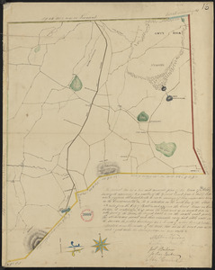
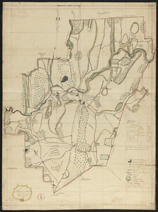
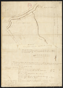
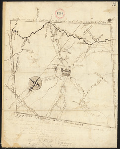
21. Plan of Ashby, surveyor's name not given, dated 1830 Format: Maps/Atlases Collection: Town plans, 1830 Date: 1830 Institution: Massachusetts Archives
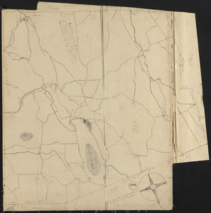
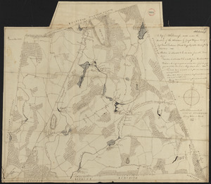
22. Plan of Ashfield made by Levi Leonard, dated December 25, 1830 Creator: Leonard, Levi Format: Maps/Atlases Collection: Town plans, 1830 Date: 1831 Institution: Massachusetts Archives
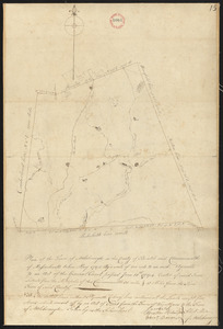
23. Plan of Ashfield, surveyor's name not given, dated May 27, 1795. Format: Maps/Atlases Collection: Town plans, 1794 Date: 1795 Institution: Massachusetts Archives
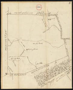
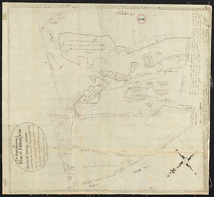
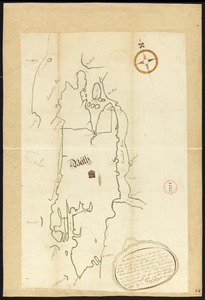
24. Plan of Athol, surveyor's name not given, dated April 27, 1795. Format: Maps/Atlases Collection: Town plans, 1794 Date: 1795 Institution: Massachusetts Archives
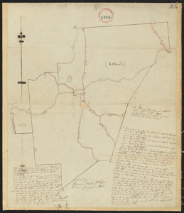
25. Plan of Athol, surveyor's name not given, dated September 1830 Format: Maps/Atlases Collection: Town plans, 1830 Date: September 1830 Institution: Massachusetts Archives
26. Plan of Attleborough made by Joseph W. Capron, dated March, 1831 Creator: Capron, Joseph W. Format: Maps/Atlases Collection: Town plans, 1830 Date: March 1831 Institution: Massachusetts Archives
27. Plan of Attleborough, surveyor's name not given, dated May, 1795. Format: Maps/Atlases Collection: Town plans, 1794 Date: 1795 Institution: Massachusetts Archives
28. Plan of Ballstown (Jefferson and Whitefield) surveyed by William Davis, dated May 20, 1795. Creator: Davis, William Format: Maps/Atlases Collection: Town plans, 1794 Date: 1795 Institution: Massachusetts Archives
29. Plan of Bangor made by Elihu Warner, dated October 20, 1795. Creator: Warner, Elihu Format: Maps/Atlases Collection: Town plans, 1794 Date: 1795 Institution: Massachusetts Archives
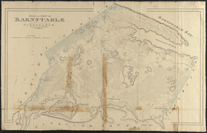
30. Plan of Barnstable made by John G. Hales, dated 1831 Creator: Hales, John Groves Format: Maps/Atlases Collection: Town plans, 1830 Date: 1831 Institution: Massachusetts Archives
31. Plan of Barnstable surveyed by Samuel Basset, dated May, 1795. Creator: Basset, Samuel Format: Maps/Atlases Collection: Town plans, 1794 Date: 1795 Institution: Massachusetts Archives
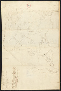
32. Plan of Barre made by David Lee and Samuel Lee, dated June 1830 Creator: Lee, David; Lee, Samuel Format: Maps/Atlases Collection: Town plans, 1830 Date: 1830 Institution: Massachusetts Archives
33. Plan of Barre surveyor's name not given, dated December, 1794. Format: Maps/Atlases Collection: Town plans, 1794 Date: 1794 Institution: Massachusetts Archives
34. Plan of Bath, Me, made by Dummer Sewall, dated March 7, 1795. Creator: Sewall, Dummer Format: Maps/Atlases Collection: Town plans, 1794 Date: 1795 Institution: Massachusetts Archives
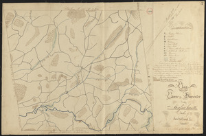
35. Plan of Becket made by Luke Barber, dated October 26, 1831 Creator: Barber, Luke Format: Maps/Atlases Collection: Town plans, 1830 Date: October 26, 1831 Institution: Massachusetts Archives
36. Plan of Becket surveyed by Christopher Crary, dated March, 1795. Creator: Crary, Christopher Format: Maps/Atlases Collection: Town plans, 1794 Date: 1795 Institution: Massachusetts Archives
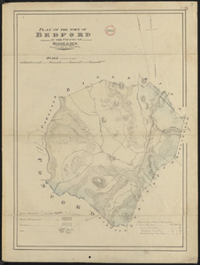
37. Plan of Bedford made by John G. Hales, dated 1830 Creator: Hales, John Groves Format: Maps/Atlases Collection: Town plans, 1830 Date: 1830 Institution: Massachusetts Archives
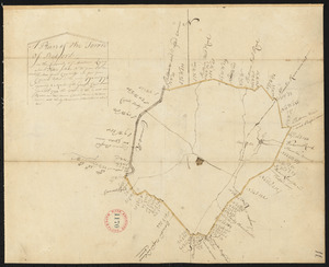
38. Plan of Bedford, surveyor's name not given, dated 1794-5. Format: Maps/Atlases Collection: Town plans, 1794 Date: 1794–1795 Institution: Massachusetts Archives
39. Plan of Belchertown made by Elias Bassett, dated November, 1830 Creator: Bassett, Elias Format: Maps/Atlases Collection: Town plans, 1830 Date: November 1830 Institution: Massachusetts Archives
40. Plan of Belchertown, surveyor's name not given, dated December, 1794. Format: Maps/Atlases Collection: Town plans, 1794 Date: 1794 Institution: Massachusetts Archives