Skip to search
Skip to main content
Skip to first result
Digital Commonwealth
Folders
Sign Up / Log In
Search for
Search
Search
Search
Basic
Advanced
Explore
Map
Collections
Institutions
Formats
For Educators
Primary Source Sets
Lesson Plans
Using Primary Sources
Searching Digital Commonwealth
For Institutions
Join Digital Commonwealth
Conferences, Trainings, & Events
How to Contribute Collections
Digitization Services
Board & Committees
Frequently Asked Questions
About
About Digital Commonwealth
News & Announcements
Copyright & Terms of Use
Harmful Content Statement
Partners
API
Contact Us
Search
Search Constraints
Start Over
Save Search
Your search:
More Like
commonwealth:2b88vr376
✖
Remove constraint More Like: commonwealth:2b88vr376
« Prev. |
1
-
20
of
121
|
Next »
Sort
by relevance
relevance
title
date (asc)
date (desc)
recently added
Number of results to display per page
20
per page
per page
10
per page
20
per page
50
per page
100
per page
View results as:
List
list view
Maps
map view
Gallery
grid view
Search Results
1.
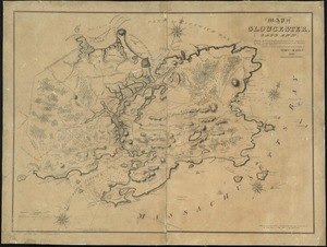
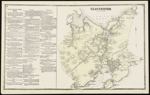
Map of Gloucester, Cape Ann : shewing the roads, harbours, rivers, coves, islands & ledges surrounding that important cape,...
2.
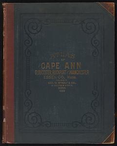
Atlas of Cape Ann, Gloucester, Rockport and Manchester, Essex County, Mass. : from official plans and actual surveys
3.
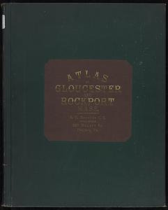
Atlas of Cape Ann, Gloucester, Rockport and Manchester, Essex County, Mass
4.
Atlas of the city of Gloucester and town of Rockport, Massachusetts : from official records, private plans and actual surveys
5.
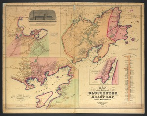
Map of the towns of Gloucester and Rockport, Essex Co., Massachusetts
6.
Balloon view, Cape Ann to Boston
7.
Plan of Ocean View, Pigeon Cove, Mass
8.
Atlas of Essex County, Massachusetts
9.
Atlas of Massachusetts
10.
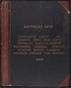
Atlas of the boundaries of the cities of Gloucester and Newburyport and towns of Amesbury, Essex, Georgetown, Groveland,...
11.
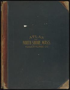
Atlas of the North Shore, Beverly to Magnolia, Essex Co., Massachusetts
12.
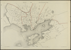
City of Gloucester
13.
Gloucester
14.
Gloucester
15.
Gloucester, Essex County, Massachusetts : Oct. 1903
16.
Gloucester Harbor, Massachusetts
17.
Gloucester Harbor, Massachusetts: Inner Harbor
18.
Harbour of Annis Squam in Ipswich Bay.
19.
Insurance maps of Gloucester, Massachusetts
20.
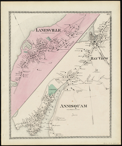
Lanesville, Bay View, Annisquam
« Previous
Next »
1
2
3
4
5
6
7
Limit your search
Subject
Gloucester (Mass.)--Maps
23
Massachusetts--Maps
19
United States--History--Civil War, 1861-1865--Maps
10
Essex County (Mass.)--Maps
7
Land use--Massachusetts--Maps
7
Massachusetts
7
Virginia--History--Civil War, 1861-1865--Maps
7
Coastal
6
more
Subject
»
Place
North and Central America
106
United States
104
Massachusetts
73
Essex (county)
28
Gloucester
20
Virginia
13
Boston
9
Suffolk (county)
9
more
Place
»
Format
Maps/Atlases
118
Books
4
Ephemera
2
Documents
1
Posters
1
Available to use
No known restrictions
105
Date
View distribution
Current results range from
1822
to
2015
Date range begin
Date range end
View larger »
Collection
Norman B. Leventhal Map & Education Center Collection
105
David Judkins Weaver Papers
96
Boston and New England Maps (Collection of Distinction)
67
Urban Maps (Collection of Distinction)
13
Historic Maps
8
Massachusetts Board of Harbor and Land Commissioners
4
Massachusetts Real Estate Atlases
4
Institution
Boston Public Library
105
Salem State University Archives and Special Collections
8
State Library of Massachusetts
8