Skip to search
Skip to main content
Skip to first result
Digital Commonwealth
Folders
Sign Up / Log In
Search for
Search
Search
Search
Basic
Advanced
Explore
Map
Collections
Institutions
Formats
For Educators
Primary Source Sets
Lesson Plans
Using Primary Sources
Searching Digital Commonwealth
For Institutions
Join Digital Commonwealth
Conferences, Trainings, & Events
How to Contribute Collections
Digitization Services
Board & Committees
Frequently Asked Questions
About
About Digital Commonwealth
News & Announcements
Copyright & Terms of Use
Harmful Content Statement
Partners
API
Contact Us
Search
Search Constraints
Start Over
Save Search
Your search:
More Like
commonwealth:3f463305r
✖
Remove constraint More Like: commonwealth:3f463305r
« Prev.
|
41
-
60
of
11,414
|
Next »
Sort
by relevance
relevance
title
date (asc)
date (desc)
Number of results to display per page
20
per page
per page
10
per page
20
per page
50
per page
100
per page
View results as:
List
list view
Maps
map view
Gallery
grid view
Search Results
41.
Siege operations at Spanish Fort, Mobile Bay : by the U.S. forces under Maj. Gen. Canby. Captured by the Army of West Miss. on...
42.
What the administration has done : map showing the progress of the national armies during the years 1861, 1862, 1863, and 1864
43.
Wyld's military map of the United States, the northern states, and the southern Confederate states : with the forts, harbours,...
44.
Antietam
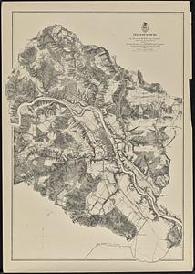
45.
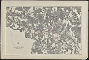
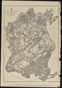
Appomattox Court House
46.
Cold Harbor
47.
Corinth, and the scene of the great Battle at Pittsburgh, Tenn. [graphic]
48.
Fredericksburg
49.
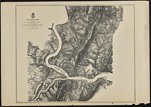
Harper's Ferry
50.
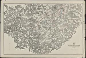
Petersburg and Five Forks
51.
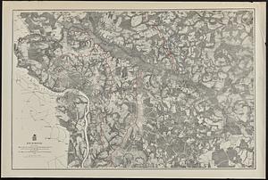
Richmond
52.
Spottsylvania Court House
53.
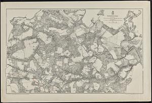
Totopotomoy
54.
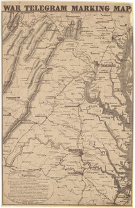
War telegram marking map
55.
The Wilderness
56.
The 100th anniversary map of Abraham Lincoln's visit to Massachusetts, September 11-23, 1848
57.
1630 shoreline
58.
1879. Progress map of the U.S. Geographical Surveys west of the 100th Meridian : prepared under the direction of 1st Lieut....
59.
1903 Map of Salem and surrounding places
60.
19th annual convention of the National Association of Real Estate Boards : at Tulsa, June 7 to June 11 in 1926
« Previous
Next »
1
2
3
4
5
6
7
…
570
571
Limit your search
Subject
Real property--Massachusetts--Boston--Maps
2,279
Landowners--Massachusetts--Boston--Maps
2,118
Boston (Mass.)--Maps
1,972
Roxbury (Boston, Mass.)--Maps
352
Dorchester (Boston, Mass.)--Maps
317
Cambridge (Mass.)--Maps
266
Brookline (Mass.)--Maps
236
Real property--Massachusetts--Cambridge--Maps
216
more
Subject
»
Place
North and Central America
8,702
United States
7,626
Massachusetts
4,959
Suffolk (county)
3,349
Boston
3,209
Europe
1,359
Middlesex (county)
618
Canada
448
more
Place
»
Format
Maps/Atlases
11,354
Manuscripts
215
Prints
56
Books
35
Objects/Artifacts
10
Drawings/Illustrations
8
Posters
4
Documents
1
Available to use
No known restrictions
11,344
Creative Commons license
46
Date
View distribution
Current results range from
1482
to
2023
Date range begin
Date range end
View larger »
Collection
Norman B. Leventhal Map & Education Center Collection
11,412
Boston and New England Maps (Collection of Distinction)
5,131
Urban Maps (Collection of Distinction)
4,861
Maritime Charts and Atlases (Collection of Distinction)
1,081
American Revolutionary War-Era Maps (Collection of Distinction)
615
Boston Redevelopment Authority Collection
87
David Judkins Weaver Papers
10
American Civil War Collection
1
more
Collection
»
Institution
Boston Public Library
11,412
Scottish Rite Masonic Museum and Library
1
State Library of Massachusetts
1


![Corinth, and the scene of the great Battle at Pittsburgh, Tenn. [graphic]](https://bpldcassets.blob.core.windows.net/derivatives/metadata/commonwealth-oai:6m3121658/image_thumbnail_300.jpg)