Skip to search
Skip to main content
Skip to first result
Digital Commonwealth
Folders
Sign Up / Log In
Search for
Search
Search
Search
Basic
Advanced
Explore
Map
Collections
Institutions
Formats
For Educators
Primary Source Sets
Lesson Plans
Using Primary Sources
Searching Digital Commonwealth
For Institutions
Join Digital Commonwealth
Conferences, Trainings, & Events
How to Contribute Collections
Digitization Services
Board & Committees
Frequently Asked Questions
About
About Digital Commonwealth
News & Announcements
Copyright & Terms of Use
Harmful Content Statement
Partners
API
Contact Us
Search
Search Constraints
Start Over
Save Search
Your search:
More Like
commonwealth:5138n263m
✖
Remove constraint More Like: commonwealth:5138n263m
« Prev.
|
21
-
40
of
164
|
Next »
Sort
by relevance
relevance
title
date (asc)
date (desc)
recently added
Number of results to display per page
20
per page
per page
10
per page
20
per page
50
per page
100
per page
View results as:
List
list view
Maps
map view
Gallery
grid view
Search Results
21.
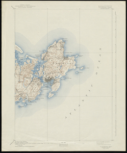
Massachusetts, Gloucester Sheet
22.
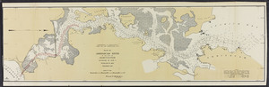
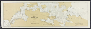
Plan of Annisquam River in the city of Gloucester
23.
Plan of Annisquam River in the city of Gloucester
24.
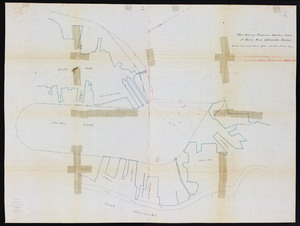
Plan showing proposed harbor line at Rocky Neck, Gloucester Harbor
25.
Atlas, city of Everett, Middlesex County, Massachusetts
26.
Atlas of Attleboro town, Massachusetts
27.
Atlas of Barnstable County, Massachusetts : towns of Bourne, Mashpee, Falmouth, Sandwich, Barnstable, Yarmouth, Dennis,...
28.
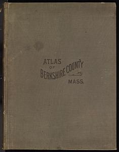
Atlas of Berkshire County, Massachusetts
29.
Atlas of Brookfield, West Brookfield and North Brookfield towns, Massachusetts
30.
Atlas of Dorchester, West Roxbury, and Brighton, City of Boston
31.
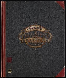
Atlas of Fall River City, Massachusetts
32.
Atlas of Franklin Co., Massachusetts : from actual surveys
33.
Atlas of Gardner town, Massachusetts
34.
Atlas of Greenfield town, Massachusetts
35.
Atlas of Haverhill and Bradford, Massachusetts
36.
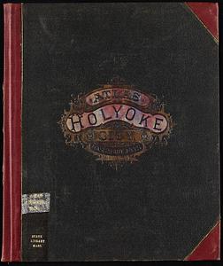
Atlas of Holyoke City, Massachusetts
37.
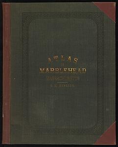
Atlas of Marblehead, Massachusetts : from official records, private plans and actual surveys
38.
Atlas of Massachusetts
39.
Atlas of Middlesex County. Vol. 1. Cambridge, Somerville, Arlington, Belmont, Watertown, Everett, Malden, Medford, Newton,...
40.
Atlas of Middlesex County. Vol. 2. Cities of Melrose & Woburn, towns of Bedford, Burlington, Concord, North Reading, Reading,...
« Previous
Next »
1
2
3
4
5
6
…
8
9
Limit your search
Subject
Landowners--Massachusetts--Boston--Maps
35
Real property--Massachusetts--Boston--Maps
35
Buildings--Massachusetts--Boston--Maps
34
Gloucester (Mass.)--Maps
23
Boston (Mass.)--Maps
12
Buildings--Massachusetts--Brookline--Maps
9
Dorchester (Boston, Mass.)--Maps
8
Massachusetts
7
more
Subject
»
Place
North and Central America
164
United States
161
Essex (county)
48
Suffolk (county)
38
Boston
36
Massachusetts
26
Middlesex (county)
26
Gloucester
20
more
Place
»
Format
Maps/Atlases
164
Books
4
Available to use
No known restrictions
9
Date
View distribution
Current results range from
1822
to
1990
Date range begin
Date range end
View larger »
Collection
Massachusetts Real Estate Atlases
143
Norman B. Leventhal Map & Education Center Collection
9
Historic Maps
8
Boston and New England Maps (Collection of Distinction)
7
Urban Maps (Collection of Distinction)
6
Massachusetts Board of Harbor and Land Commissioners
4
David Judkins Weaver Papers
1
Institution
State Library of Massachusetts
147
Boston Public Library
9
Salem State University Archives and Special Collections
8