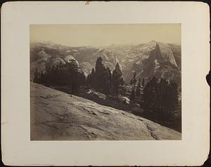
Skip to search
Skip to main content
Skip to first result
Digital Commonwealth
Folders
Sign Up / Log In
Search for
Search
Search
Search
Basic
Advanced
Explore
Map
Collections
Institutions
Formats
For Educators
Primary Source Sets
Lesson Plans
Using Primary Sources
Searching Digital Commonwealth
For Institutions
Join Digital Commonwealth
Conferences, Trainings, & Events
How to Contribute Collections
Digitization Services
Board & Committees
Frequently Asked Questions
About
About Digital Commonwealth
News & Announcements
Copyright & Terms of Use
Harmful Content Statement
Partners
API
Contact Us
Search
Search Constraints
Start Over
Save Search
Your search:
More Like
commonwealth:70796f03r
✖
Remove constraint More Like: commonwealth:70796f03r
« Prev.
|
181
-
200
of
5,911
|
Next »
Sort
by relevance
relevance
title
date (asc)
date (desc)
recently added
Number of results to display per page
20
per page
per page
10
per page
20
per page
50
per page
100
per page
View results as:
List
list view
Maps
map view
Gallery
grid view
Search Results
181.
Cross Mountain, Western Arizona, 1,350 miles from Missouri River.
182.
Crossing of the Sierra Nevadas, California; "Tehachapa Pass," 1,720 miles west of Missouri River.
183.
Crossing of the Sierras at Tehachapa Pass, California,
184.
Curicante [i.e. Curecanti] Needle, Black Cañon of the Gunnison
185.
Cygnus Mountain, on Head-waters of Bill Williams' River, Western Arizona, 1,350 miles west of Missouri River.
186.
Dale Creek Bridge, from above.
187.
Dale Creek Bridge, general view.
188.
Decesending the Western Slope of the Sierra Nevada, in Tehachapa Pass, California, 1,710 miles from Missouri River.
189.
Depot of Pacific Railroad, St. Louis, Mo.
190.
Devil's Gate, Dale Creek Canon.
191.
Dial Rock, Red Buttes.
192.
Distant view of Camp Apache, Arizona
193.
The Domes from Sentinel Dome, Yosemite (A)
194.
The Domes from Sentinel Dome, Yosemite (A)
195.
Dumpling Mountain, adjoining Val de Chino, Arizona, 1,290 miles west of Missouri River.
196.
Eagle Bear, Sioux
197.
East end of tunnel, Weber Canon.
198.
Eastern approach to Dale Creek Bridge.
199.
An elk, Cervus Canadensis
200.
Engineer camp at the Zuni Pass, in the Sierra Madre, N.M., 975 miles west of Missouri River.
« Previous
Next »
1
2
…
6
7
8
9
10
11
12
13
14
…
295
296
Limit your search
Subject
Rivers
5,385
Bridges
1,073
Cities & towns
699
Boats
603
Trees
438
Bodies of water
343
Waterfronts
325
Piers & wharves
310
more
Subject
»
Place
North and Central America
4,547
United States
4,437
Massachusetts
2,806
Charles
740
Suffolk (county)
625
Essex (county)
606
Middlesex (county)
605
Europe
581
more
Place
»
Format
Photographs
4,082
Postcards/Cards
893
Prints
821
Drawings/Illustrations
65
Manuscripts
55
Maps/Atlases
49
Paintings
49
Ephemera
24
more
Format
»
Available to use
No known restrictions
3,117
Creative Commons license
1,000
Date
View distribution
Current results range from
1747
to
2016
Date range begin
Date range end
View larger »
Unknown
25
Collection
Project DOCUMERICA Photographs by Ernst Halberstadt
609
Photographs of the American West
572
Tichnor Brothers Postcard Collection
543
Historical Society of Old Yarmouth Archives and Local History Collection
349
Stereograph Collection
341
British Artists
330
Bill Lane Photograph Collection
270
Arthur Griffin Photographs
256
more
Collection
»
Institution
Boston Public Library
3,593
Historical Society of Old Yarmouth
383
Newburyport Public Library
270
Griffin Museum of Photography
256
Historical Society of Old Newbury
173
The Medford Historical Society & Museum
157
Phillips Library at the Peabody Essex Museum
142
Lawrence Public Library
87
more
Institution
»