Skip to search
Skip to main content
Skip to first result
Digital Commonwealth
Folders
Sign Up / Log In
Search for
Search
Search
Search
Basic
Advanced
Explore
Map
Collections
Institutions
Formats
For Educators
Primary Source Sets
Lesson Plans
Using Primary Sources
Searching Digital Commonwealth
For Institutions
Join Digital Commonwealth
Conferences, Trainings, & Events
How to Contribute Collections
Digitization Services
Board & Committees
Frequently Asked Questions
About
About Digital Commonwealth
News & Announcements
Copyright & Terms of Use
Harmful Content Statement
Partners
API
Contact Us
Search
Search Constraints
Start Over
Save Search
Your search:
More Like
commonwealth:70796m459
✖
Remove constraint More Like: commonwealth:70796m459
« Prev.
|
701
-
720
of
789
|
Next »
Sort
by relevance
relevance
title
date (asc)
date (desc)
recently added
Number of results to display per page
20
per page
per page
10
per page
20
per page
50
per page
100
per page
View results as:
List
list view
Maps
map view
Gallery
grid view
Search Results
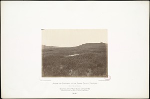
701.
Sierra Clara, between Wagon Mountain and Apache Hill, 16 miles from Fort Union, New Mexico; 717 miles west of Missouri River.
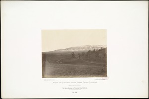
702.
The Sierra Nevadas, at Tehachapa Pass, California, 1,700 miles from Missouri River.
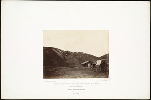
703.
Sinks of Tehachapa, California.
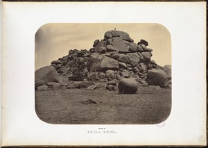
704.
Skull Rock.
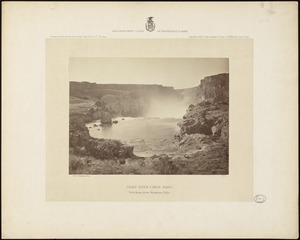
705.
Snake River Cañon, Idaho, view from above Shoshone Falls
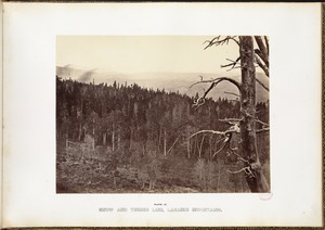
706.
Snow and timber line, Laramie Mountains.
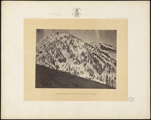
707.
Snow peaks, Bull Run Mining District, Nevada
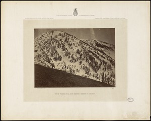
708.
Snow peaks, Bull Run Mining District, Nevada
709.
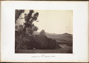
Source of the Laramie River.
710.
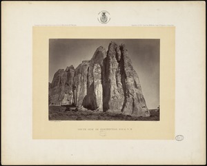
South side of Inscription Rock, N.M.
711.
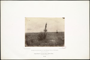
"Spanish Bayonet," on the Great Plains in Western Kansas, 418 miles west of Missouri River.
712.
The Spanish Peaks
713.
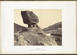
Sphynx of the Valley.
714.
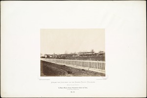
St. Mary's Mission, Kansas, Pottawattamie School and Farm, 90 miles west of Missouri River.
715.
The start from Camp Mojave, Arizona
716.
State line between Kansas and Missouri, near Kansas City, 275 miles west of St. Louis, Mo.
717.
Stone Quarry at Fort Lyon, Southern Colorado, 525 miles from Missouri River.
718.
Summit of Sierra Nevada at Tehachapa Pass, California, February, 1868; 4,008 feet above the ocean, 1,701 miles from Missouri...
719.
Supply trains.
720.
Surveying Party at Agua Frio, in Sierra Madre, New Mexico, (The Water Shed of the Continent,) 970 miles west of Missouri River.
« Previous
Next »
1
2
…
32
33
34
35
36
37
38
39
40
Limit your search
Subject
Indians of North America
337
Indigenous peoples
137
Trans-Mississippi and International Exposition (1898 : Omaha, Neb.)
113
Mountains
80
Union Pacific Railroad Company
50
Rivers
45
Rock formations
32
Trees
31
more
Subject
»
Place
North and Central America
542
United States
497
Massachusetts
103
Arizona
76
California
75
Colorado
60
New Mexico
56
Western United States
50
more
Place
»
Format
Photographs
736
Prints
20
Objects/Artifacts
10
Documents
5
Ephemera
5
Books
4
Manuscripts
4
Paintings
4
more
Format
»
Available to use
No known restrictions
599
Creative Commons license
17
Date
View distribution
Current results range from
1765
to
2019
Date range begin
Date range end
View larger »
Unknown
2
Collection
Photographs of the American West
570
Leslie Jones Collection
93
Stereograph Collection
56
Arthur Griffin Photographs
36
Plymouth Tercentenary Photographs
9
Social and Political Cartoons
9
Art and Artifacts Collection
7
Boston Children’s Museum Lantern Slides
6
more
Collection
»
Institution
Boston Public Library
683
Griffin Museum of Photography
36
Historical Society of Old Yarmouth
9
Plymouth Public Library
9
Nahant Public Library
7
Boston Children's Museum
6
Arlington Historical Society
4
Special Collections and University Archives, University of Massachusetts Amherst Libraries
4
more
Institution
»