1. Sketch of the states of Massachusetts, Connecticut, and Rhode Island, and parts of New Hampshire & New York exhibiting the several rail road routes completed,... Creator: Kennedy, Archibald, active 1850 Format: Maps/Atlases Collection: Boston and New England Maps (Collection of Distinction) / Norman B. Leventhal Map & Education Center Collection Date: 1846 Institution: Boston Public Library
2. Sketch of the states of Massachusetts, Connecticut, and Rhode Island, and parts of New Hampshire & New York exhibiting the several rail road routes completed,... Creator: Kennedy, Archibald, fl. 1850 Format: Maps/Atlases Collection: Boston and New England Maps (Collection of Distinction) / Norman B. Leventhal Map & Education Center Collection Date: 1838 Institution: Boston Public Library
3. Map of Massachusetts, Connecticut and Rhode Island constructed from the latest authorities Format: Maps/Atlases Collection: Boston and New England Maps (Collection of Distinction) / Norman B. Leventhal Map & Education Center Collection Date: 1843 Institution: Boston Public Library
4. Map of Massachusetts, Connecticut and Rhode Island constructed from the latest authorities Format: Maps/Atlases Collection: Boston and New England Maps (Collection of Distinction) / Norman B. Leventhal Map & Education Center Collection Date: 1849 Institution: Boston Public Library
5. Map of Massachusetts, Rhode-Island & Connecticut : compiled from the latest authorities Creator: Wells, J. Format: Maps/Atlases Collection: Boston and New England Maps (Collection of Distinction) / Norman B. Leventhal Map & Education Center Collection Date: 1843 Institution: Boston Public Library
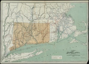
6. Map of the railroads of Connecticut : to accompany the report of the Railroad Commissioners Format: Maps/Atlases Collection: Boston and New England Maps (Collection of Distinction) / Norman B. Leventhal Map & Education Center Collection Date: 1895 Institution: Boston Public Library
7. The National Publishing Company's railroad, post office, township and county map of Massachusetts, Rhode Island and Connecticut : with distances in figures compiled... Creator: National Publishing Company (Boston, Mass.) Format: Maps/Atlases Collection: Norman B. Leventhal Map & Education Center Collection Date: [ca. 1902] Institution: Boston Public Library
8. Post route map of the states of Massachusetts, Rhode Island, Connecticut showing post offices with the intermediate distances on mail routes in operation on the 1st of... Creator: United States. Post Office Dept Format: Maps/Atlases Collection: Norman B. Leventhal Map & Education Center Collection Date: 1903 Institution: Boston Public Library
9. New York, New Haven & Hartford Railroad : Old Colony system Creator: Rand Avery Supply Co.; Ellis, George H. (Printer) Format: Maps/Atlases Collection: Boston and New England Maps (Collection of Distinction) / Norman B. Leventhal Map & Education Center Collection Date: 1893 Institution: Boston Public Library
10. Route of the proposed Providence & Worcester rail-road Creator: Providence and Worcester Railroad Company, Rhode Island, Massachusetts, Atwater, S., and Schubarht, N.B. Format: Maps/Atlases Collection: Boston and New England Maps (Collection of Distinction) / Norman B. Leventhal Map & Education Center Collection Date: 1844 Institution: Boston Public Library
11. Route of the Providence and Worcester rail road Creator: J.H. Bufford's Lith Format: Maps/Atlases Collection: Boston and New England Maps (Collection of Distinction) / Norman B. Leventhal Map & Education Center Collection Date: 1847 Institution: Boston Public Library
12. Old Colony Railroad and connections Creator: Winslow, E. N.; J.H. Bufford's Lith. Format: Maps/Atlases Collection: Sidney R. Knafel Map Collection at Phillips Academy Date: [ca. 1872–1888] Institution: Phillips Academy
13. Connecticut Creator: George F. Cram Company Format: Maps/Atlases Collection: Boston and New England Maps (Collection of Distinction) / Norman B. Leventhal Map & Education Center Collection Date: 1921 Institution: Boston Public Library
14. [Boston and Northwestern Junction Railroad] Creator: Philbrick, Edward Southwick, 1827-1889 Format: Maps/Atlases Collection: Boston and New England Maps (Collection of Distinction) / Norman B. Leventhal Map & Education Center Collection Date: [1879] Institution: Boston Public Library
15. Dinsmore's new railroad map of the United States and the Canadas, showing all the railroads completed and in progress, carefully compiled from official sources, for... Format: Maps/Atlases Collection: Norman B. Leventhal Map & Education Center Collection Date: [1860] Institution: Boston Public Library
16. Hale's map of the central & western parts of Massachusetts, with a part of New-York Creator: Boston and Albany Railroad Co Format: Maps/Atlases Collection: Boston and New England Maps (Collection of Distinction) / Norman B. Leventhal Map & Education Center Collection Date: 1877 Institution: Boston Public Library
17. Map of Baldwinville and Winchendon rail road routes Format: Maps/Atlases Collection: Boston and New England Maps (Collection of Distinction) / Norman B. Leventhal Map & Education Center Collection Date: [1850–1859] Institution: Boston Public Library
18. Map of street railways in eastern Massachusetts Creator: Derrah, Robert H. Format: Maps/Atlases Collection: Boston and New England Maps (Collection of Distinction) / Norman B. Leventhal Map & Education Center Collection Date: 1897 Institution: Boston Public Library
19. Map of the Boston-Worcester century run Creator: Geo. H. Walker & Co Format: Maps/Atlases Collection: Boston and New England Maps (Collection of Distinction) / Norman B. Leventhal Map & Education Center Collection Date: [ca. 1896] Institution: Boston Public Library
20. Map of the country copied from Hale's map of N. E. with railroad route from Boston to Lake Champlain : through Keene, N. H Format: Maps/Atlases Collection: Boston and New England Maps (Collection of Distinction) / Norman B. Leventhal Map & Education Center Collection Date: 1845 Institution: Boston Public Library


![[Boston and Northwestern Junction Railroad]](https://bpldcassets.blob.core.windows.net/derivatives/images/commonwealth:x059cc74n/image_thumbnail_300.jpg)


