Skip to search
Skip to main content
Skip to first result
Digital Commonwealth
Folders
Sign Up / Log In
Search for
Search
Search
Search
Basic
Advanced
Explore
Map
Collections
Institutions
Formats
For Educators
Primary Source Sets
Lesson Plans
Using Primary Sources
Searching Digital Commonwealth
For Institutions
Join Digital Commonwealth
Conferences, Trainings, & Events
How to Contribute Collections
Digitization Services
Board & Committees
Frequently Asked Questions
About
About Digital Commonwealth
News & Announcements
Copyright & Terms of Use
Harmful Content Statement
Partners
API
Contact Us
Search
Search Constraints
Start Over
Save Search
Your search:
More Like
commonwealth:8049gp14t
✖
Remove constraint More Like: commonwealth:8049gp14t
« Prev.
|
101
-
120
of
5,156
|
Next »
Sort
by relevance
relevance
title
date (asc)
date (desc)
recently added
Number of results to display per page
20
per page
per page
10
per page
20
per page
50
per page
100
per page
View results as:
List
list view
Maps
map view
Gallery
grid view
Search Results
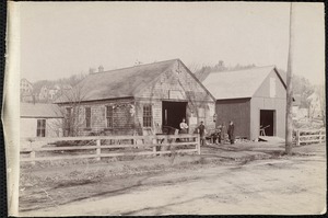
101.
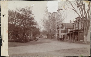
Tatro's blacksmith shop, lower Prospect Street
102.
This appears to be the building of the aqueduct over the Assabet River in Nortboro
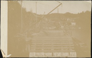
103.
This appears to be the building of the aqueduct over the Assabet River in Northboro
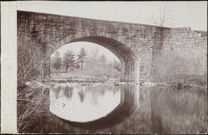
104.
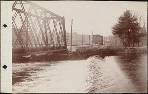
This is the present railroad bridge carrying the present railroad over the entering Quinepoxet River
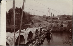
105.
This is the Scar Bridge over the Mass Central Railroad before the reservoir where it was redirected at the Clinton Dam.
106.
Three men and a horse pulling a mining car
107.
Three unidentified men
108.
Tree beside an unidentified house
109.
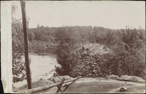
The triangle in valley
110.
The twin trestle bridges of the Mass Central Railroad
111.
Two men working on a railroad track
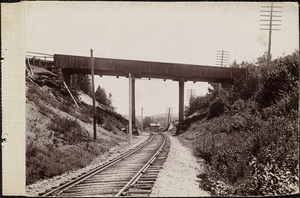
112.
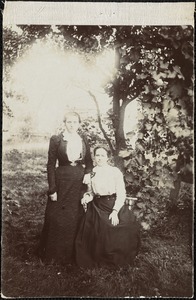
Two unidentified women
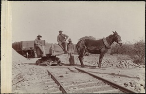
113.
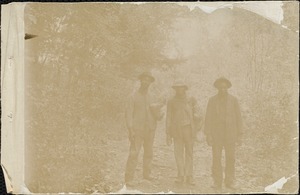
Unidentified, cleared land
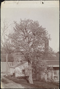
114.
Unidentified group of children
115.
Unidentified group of people
116.
Unidentified house
117.
Unidentified house
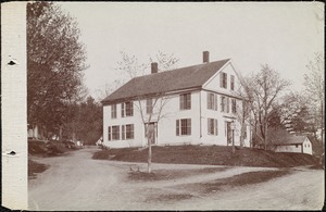
118.
Unidentified house with barn
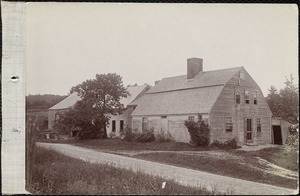
119.
Unidentified house with tree and fence in the foreground
120.
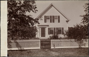
Unidentified house with white fence
« Previous
Next »
1
2
3
4
5
6
7
8
9
10
…
257
258
Limit your search
Subject
Roads
3,552
Cities and towns
1,680
Land use mapping
1,680
Soil mapping
1,680
United States. Work Projects Administration
1,680
United States. Works Progress Administration
1,680
Winter
1,516
Snow
843
more
Subject
»
Place
North and Central America
4,404
United States
4,365
Massachusetts
3,865
Middlesex (county)
517
Suffolk (county)
506
Boston
487
Essex (county)
469
Worcester (county)
443
more
Place
»
Format
Photographs
2,488
Maps/Atlases
1,692
Postcards/Cards
728
Prints
151
Film/Video
60
Manuscripts
42
Drawings/Illustrations
30
Albums/Scrapbooks
22
more
Format
»
Available to use
No known restrictions
3,001
Creative Commons license
635
Date
View distribution
Current results range from
1683
to
2014
Date range begin
Date range end
View larger »
Unknown
85
Collection
Land study maps, 1936-1937
1,680
Tichnor Brothers Postcard Collection
576
Bill Lane Photograph Collection
217
College Archives Digital Collections
197
Leon Abdalian Collection
187
Leslie Jones Collection
187
Spencer Grant Collection
157
Needham Historical House Collection
148
more
Collection
»
Institution
Massachusetts Archives
1,680
Boston Public Library
1,510
Newburyport Public Library
217
Springfield College Archives and Special Collections
204
Arlington Historical Society
168
Needham Free Public Library
151
Beaman Memorial Library
112
Cape Cod Community College
79
more
Institution
»